Beginner guide
How to use God's Eye View
Open the hosted map, wait for a count in the header, then ask one question. This guide is the setup you need — not a local install, and not a list of API tokens.
The only habit that matters
Open Layers. Click All off. Enable one row: Aircraft (ADS-B) for planes, Vessels (AIS) for ships, Earthquakes or Active Fires for hazards. If the row is not highlighted, that layer is off. A globe with every feed lit is unreadable.
Search beats wandering
The header search accepts a callsign, ICAO hex, MMSI, launch name, camera, or city. Click the result. Read the data panel. Share the view when you have a time and a place, not a vibe.
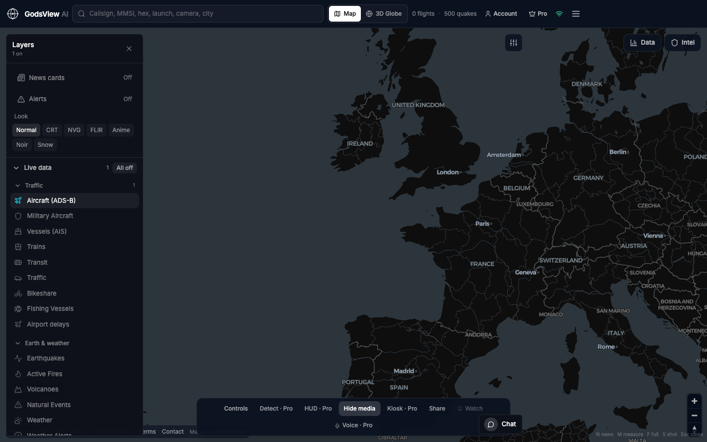
How to use this view
- Open the live map. Wait until the header shows a flight or vessel count.
- Layers → All off → enable only the feed for your question.
- Search if you already have a callsign, hex, or MMSI.
- Click a contact. Read altitude, speed, and timestamp in Data.
- Stay on Map for work. Use 3D Globe when you want the shot.
Data source, update rate, and limits
Feeds refresh on their own clocks: ADS-B about every 20 seconds, AIS on a similar cadence, USGS and FIRMS more slowly. The map is hosted. You do not paste API keys.
This is public broadcast and agency data, not classified GEOINT. Empty water is often a coverage hole. A military hex that is dark is not a proof of anything. Do not time evacuations or navigation off a consumer map.
Questions
Do I need to download God’s Eye View?
No. GodsView AI is the hosted map. Open the site in a browser. We do not ship a self-hosted GodsView product.
Why is the map empty?
Usually every layer is still off, or you are zoomed to a quiet box. Enable one layer and wait for the header count.
Is this the GitHub globe?
No. github.com/bilawalsidhu/gods-eye-view is a local Cesium project. This site is a different, hosted product. See the compare page if you are choosing.
Do I need an account?
Not for the live map. Account is for the forum, watchlists, and optional Premium.
Can I share what I am looking at?
Yes. Use Share on the map, or open a tracker page and copy that URL. Hash links also store lat, lon, zoom, and which layers are off.
Related trackers
Optional email list: subscribe from the page in a browser, or open an account.