Public ADS-B only
Live military flight tracker
This layer shows only military aircraft that broadcast ADS-B and are tagged as military in a public feed. Tankers, transports and surveillance aircraft often appear; aircraft on sensitive missions usually do not.
Europe, the UK and the USA
Saved views exist for military flights over Europe, the UK and the USA, and each has a shareable URL. They show only aircraft that are transmitting, so a quiet area does not mean an empty sky.
How to read a contact
Keep civil Aircraft on. Seeing a military icon among ordinary airliners is a reminder that both come from the same public broadcast system. Hex code, callsign, altitude and speed are in the data panel. Describe what you share as public ADS-B data.
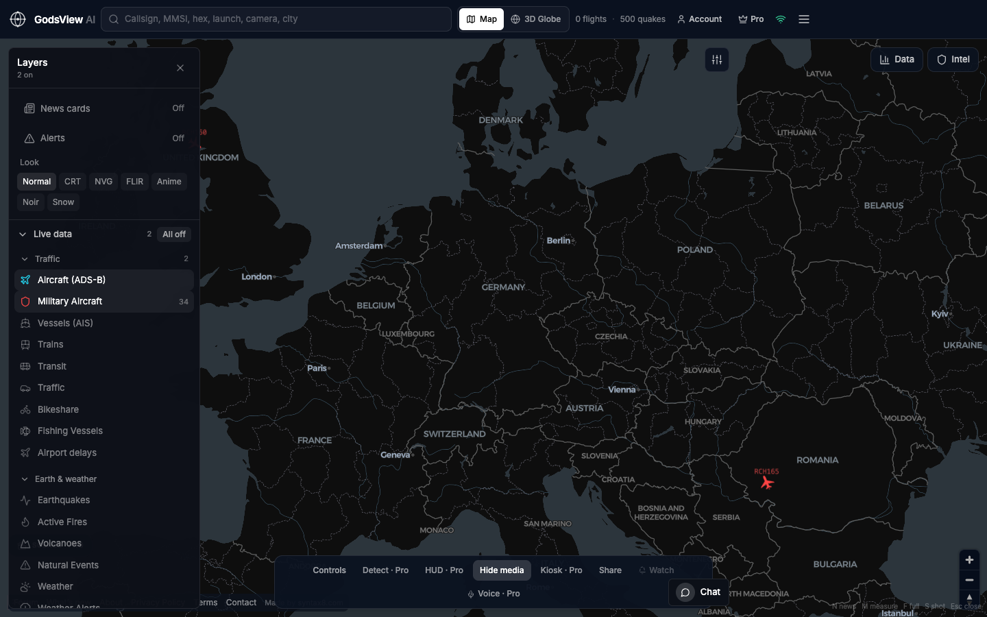
How to use this view
- Launch with Aircraft and Military Aircraft enabled (military is a Plus layer).
- Start over Europe or the US, where public receiver coverage is densest.
- Click a military contact and note its hex code and the report time.
- Use a saved view link to put a colleague on the same area.
Data source, update rate, and limits
Military positions come from the adsb.lol military feed and refresh about every 15 seconds, shown alongside civil ADS-B for context. Plus also adds alerts when a military aircraft enters an area you watch.
Many military aircraft do not broadcast ADS-B or switch it off, and some broadcasts may be incomplete or misidentified. This view is not suitable for operational or safety decisions.
Questions
Why don’t I see fighter jets?
Many combat aircraft do not broadcast ADS-B, or turn it off on operational flights. Their absence from the map says nothing about whether they are flying.
Is there a 3D view?
Yes. Switch to 3D Globe from the header after you launch. The 2D map is usually easier for clicking and reading details.
Can I watch the UK only?
Open the UK saved view, or zoom the map to around 54°N, 2°W.
Does it include classified data?
No. Everything on this layer comes from public ADS-B broadcasts.
How is this different from civil tracking?
It uses the same ADS-B broadcasts, filtered to aircraft identified as military in a public feed.
Related trackers
Optional email list: subscribe from the page in a browser, or open an account.