Explainer
Military Aircraft Tracking Explained: What You Can See
Some military aircraft broadcast their position like any airliner, some appear only through multilateration, and many never appear at all. Here is why, and how to read what you do see responsibly.
Key takeaways
- Military aircraft appear on public maps only when they transmit and a receiver hears them; tracking sites do not have access to military radar.
- US rules let aircraft on sensitive government missions switch ADS-B Out off, so absence on the map tells you very little.
- Many military aircraft carry Mode S transponders without ADS-B position, so they are placed by multilateration or not at all.
- Commercial trackers block most military and some private aircraft; community aggregators such as ADS-B Exchange, adsb.lol, adsb.fi and airplanes.live describe themselves as unfiltered.
- What you see is a voluntary, partial broadcast picture, and sharing it carries real responsibilities.
You can track military aircraft only when they choose to broadcast and a public receiver hears them. Many tankers, transports and patrol aircraft transmit ADS-B or Mode S while flying in civil airspace, so they appear on unfiltered maps. Fighters on exercises, aircraft on sensitive missions and anything with its transponder off do not, and some popular trackers filter military traffic out even when it is broadcasting.
So a military flight map is a picture of what was voluntarily transmitted, not a view of military activity. That distinction is the key to reading it well. This explainer covers why some aircraft show and others do not, how hex codes and databases are used to label military traffic, the US privacy programs that affect what is displayed, the difference between filtered and unfiltered feeds, and the ethics of watching and sharing this data.
If you want to look while you read, the military flight tracker shows the layer on a live map.
Open the military flight tracker
Can you track military aircraft at all?
Yes, within limits. Public flight tracking relies on aircraft broadcasting their own data, which our guide on how ADS-B flight tracking works explains in detail. There is no public access to military radar. Every military aircraft you see on a hobby map is there because its own transponder sent something that a volunteer receiver picked up.
That has two consequences. First, what appears is shaped by the aircraft's equipment and its crew's choices, not by the tracker. Second, the picture is biased toward aircraft that fly in or near civil airspace, where broadcasting helps air traffic control and collision avoidance.
Why do some military aircraft show on flight trackers?
Military aircraft share the sky with airliners. When they cross civil airspace, file flight plans with civil controllers or fly long ferry and transport legs, transmitting position supports safe separation. The military aircraft that show up on public maps therefore tend to be types that spend long periods in shared airspace, such as transports and tankers.
There is also a technical reason. A Mode S transponder answers radar interrogations on 1090 MHz with identity and altitude even if it does not broadcast a GPS position. According to Flightradar24, some older civilian aircraft and many military aircraft are equipped only with Mode S, and their positions have to be calculated by multilateration. So a military aircraft can appear on a map without ever sending its own latitude and longitude.
Why do other military aircraft never appear?
Several separate reasons, often combined:
- Transmitters off by rule. The US ADS-B rule requires equipped aircraft to transmit at all times, but it carves out an exception when the FAA authorizes an aircraft on a sensitive government mission for national defense, homeland security, intelligence or law enforcement to stop, because transmitting would compromise operations security or safety (14 CFR 91.225(f)).
- No ADS-B position fitted. Aircraft with Mode S only can be placed by multilateration, but only when four or more receivers hear them. Flightradar24's support pages say MLAT generally works only above roughly 3,000 to 10,000 feet, so low flying aircraft drop out.
- Military-only formats. The Mode S standard reserves downlink format 19 for military extended squitter (The 1090 Megahertz Riddle). Messages in military formats are not decoded the same way as civil ADS-B.
- No receivers nearby. Operating areas over open ocean, deserts and restricted zones often have no hobby receivers in range.
- Filtered by the tracker. Many commercial sites hide military traffic even when it is received. More on this below.
The practical lesson: an empty patch of sky on a map is not evidence that nothing is flying there.
How trackers identify military aircraft
ADS-B messages do not carry a "military" flag that every tracker reads. Instead, sites infer it.
ICAO address blocks and registration databases
Every aircraft broadcasts a 24-bit ICAO address, shown as a six-character hex code. ICAO gives each state a block of addresses, and the state assigns individual addresses to its aircraft (SKYbrary). Community and commercial databases record which addresses belong to which operators, including air forces, so a tracker can label an aircraft military by looking up its hex code. The adsb.lol API, for example, offers a dedicated endpoint for military registered aircraft built on this kind of lookup.
Callsigns, types and squawks
Callsigns help too. Military flights may use operator-specific callsign words rather than airline designators, and the aircraft type (a tanker or transport type, for instance) is a strong hint. Squawk codes add context: the FAA reserves code 7777 for military interceptor operations and tells civil pilots never to use it (FAA AIM chapter 4).
Each of these signals can be wrong. Databases lag behind transfers, some government aircraft carry civil registrations, and some civil contractors fly military support missions. Treat a "military" label as a database opinion, not a confirmed fact.
LADD and PIA: privacy programs that hide aircraft
Two FAA programs shape what US flight trackers display. They apply mainly to civil aircraft, but they explain a lot of the gaps people attribute to military secrecy.
| Program | What it does | What it does not do |
|---|---|---|
| LADD (Limiting Aircraft Data Displayed) | Lets owners have their aircraft filtered from the FAA's SWIM data feed or from public display by participating tracking websites, which agree to filter under an FAA data access agreement | It does not stop the aircraft broadcasting ADS-B; a receiver that does not use FAA data still hears it |
| PIA (Privacy ICAO Address) | Lets eligible US-registered, 1090 MHz aircraft using a third-party callsign fly with a temporary ICAO address that is not linked to the owner in the civil aircraft registry | It is valid only in US-managed airspace and does not hide the aircraft's position, only who it belongs to |
Both are described on the FAA's own pages for LADD and PIA. The LADD page also notes that requests for US government, military or law enforcement aircraft go through FAA System Operations Security rather than the public form. The PIA page says operators can request a new address 20 days after a previous assignment.
Flightradar24 says it limits or blocks a small number of flights at owners' request through programs such as LADD, and that for security and privacy it limits or blocks most military aircraft and certain high-profile aircraft, such as Air Force One.
Filtered vs unfiltered flight trackers
The biggest difference between flight trackers for military watching is not coverage; it is policy.
| Tracker | Stated approach | Source |
|---|---|---|
| Flightradar24 | Blocks or limits most military aircraft and some private aircraft; includes a "Military" category filter for what it does show | FR24 support |
| ADS-B Exchange | Says it shows aircraft without filtering specific flights or types, covering civil and military traffic | ADS-B Exchange about |
| adsb.lol | Describes itself as an open, unfiltered network and publishes LADD, PIA and military lists in its API | adsb.lol |
| adsb.fi | Community tracker offering open and unfiltered access | adsb.fi |
| airplanes.live | Community aggregator that says it never filters or obfuscates aircraft data | airplanes.live |
"Unfiltered" means the site does not deliberately remove aircraft it receives. It does not mean complete: unfiltered networks still miss everything their receivers cannot hear and everything that is not transmitting. For a deeper look at the two best-known trackers, see ADS-B Exchange vs Flightradar24.
How the GodsView military layer works
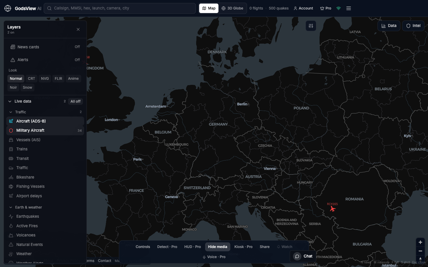
On GodsView AI, the military aircraft layer is a Pro feature. It uses the adsb.lol military feed and refreshes about every 15 seconds, drawn on the same map as civil flights, ships and satellites. Pro also offers alerts when military aircraft enter an area you define, delivered in-app, by browser push or by email.
Military ADS-B and emergency squawks also feed the free-to-view Ops Center, where they sit alongside earthquakes, disaster alerts, outages and news as inputs to scored incidents. The methodology page lists every source and refresh interval.
A practical tip: keep civil traffic visible when you look at military aircraft. It reminds you that you are looking at broadcasts in shared airspace, and it makes unusual patterns easier to judge against normal traffic.
A simple routine for watching military traffic
If you want to use the layer for research or news monitoring, a consistent routine keeps you from over-reading it.
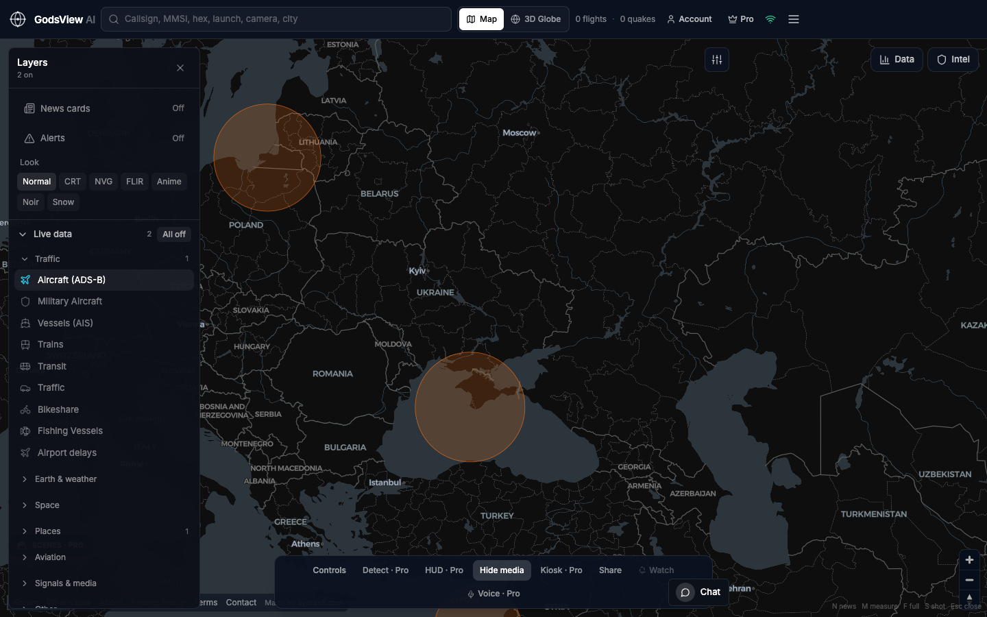
- Start with context. Open a region view such as the Ukraine live map or the Middle East live map so you see the area in context before you zoom in on aircraft.
- Turn on civil and military aircraft together. Normal airline flows show you which airspace is open and busy.
- Check interference. Look at the GPS jamming map before trusting odd track shapes in that area.
- Note identifiers and times. Record the hex code, callsign and UTC time of anything you plan to cite.
- Replay before concluding. Where a track history is available, replaying it often turns a "sudden" event into a routine pattern.
What military flight data can and cannot tell you
What it can show: that an aircraft with a given hex code and callsign transmitted from a given position, altitude and speed at a given time, and the shape of its track. Over days, it can show routine patterns such as regular transport routes or orbits flown by tankers and patrol aircraft over international waters.
What it cannot show: intent, mission, payload, or anything about aircraft that are not transmitting. A tanker orbit near a border may be routine training. A sudden absence may mean the crew switched off, flew below coverage or entered a GPS interference zone; our guide to GPS jamming and spoofing explains how interference distorts tracks. Positions can also be wrong when jamming or spoofing corrupts the aircraft's own navigation.
Researchers who use flight data in open-source investigations treat it as one source to corroborate with others. Our primer on what OSINT is covers that verification workflow, and the OSINT map brings several layers together.
Is it legal and ethical to track military aircraft?
In most countries, receiving unencrypted radio broadcasts and viewing them on a public website is lawful, but laws differ, and some places restrict photographing or reporting on military activity. Our article on whether flight and ship tracking is legal covers the general picture. This is not legal advice; check the rules where you live.
Ethics go further than legality. A few principles worth following:
- Delay and generalize. Posting a live position of a specific aircraft during an active operation can create risks that a summary hours later does not.
- Label uncertainty. Say "appears to be" and cite the hex code and time, rather than asserting a mission you cannot see.
- Avoid people. Do not use aircraft data to locate, follow or harass individuals, military or civilian.
- Respect privacy programs. If an owner has used LADD or PIA, think carefully before publishing who they are.
The short version
Military aircraft show up on public maps when they broadcast ADS-B or Mode S and a receiver hears them, usually while sharing civil airspace. Many never appear because the rules allow sensitive missions to stay silent, because Mode S-only aircraft need four receivers for MLAT, or because a commercial tracker filters them. Unfiltered community networks show more, but never everything.
Read the layer as a partial, voluntary signal, label your uncertainty, and think before you share live positions.
Frequently asked questions
Why are military planes not on Flightradar24?
Flightradar24 says that for security and privacy it limits or blocks most military aircraft and some high-profile aircraft such as Air Force One, and it filters owners who use programs like the FAA LADD list. Separately, many military aircraft are not broadcasting at all, or only send Mode S replies that need multilateration from several receivers.
Which flight tracker shows military aircraft?
Community aggregators that describe themselves as unfiltered, such as ADS-B Exchange, adsb.lol, adsb.fi and airplanes.live, display the military aircraft their receivers hear. GodsView Pro has a military layer built on the adsb.lol military feed. None can show aircraft that are not transmitting, so every military map is incomplete.
Do military aircraft have to use ADS-B?
In the United States, 14 CFR 91.225 requires ADS-B Out in most controlled airspace and requires equipped aircraft to transmit at all times, but it allows the FAA to authorize aircraft on sensitive national defense, homeland security, intelligence or law enforcement missions to stop transmitting. Many military aircraft also operate under separate arrangements or outside civil airspace.
What is the difference between LADD and PIA?
LADD asks the FAA and participating tracking sites to filter an aircraft from public display of FAA-sourced data; the aircraft still broadcasts. PIA gives an eligible US aircraft a temporary ICAO address not linked to its owner in the public registry, so its position is visible but harder to attribute. Both are FAA programs for civil operators.
Is it legal to track military aircraft?
Receiving unencrypted aircraft broadcasts and viewing them online is generally lawful in many countries, but rules vary and some places restrict reporting on military activity. Avoid publishing live positions during active operations and never use the data to locate or harass people. This is general information, not legal advice; check your local laws.
Sources
- eCFR — 14 CFR 91.225(f), ADS-B Out transmit requirement and exceptions
- FAA — Limiting Aircraft Data Displayed (LADD)
- FAA — ADS-B Privacy ICAO Address (PIA)
- Flightradar24 — How Flightradar24 works
- Flightradar24 support — Why does it say a flight is blocked?
- ADS-B Exchange — About
- adsb.lol — API documentation (military, LADD and PIA endpoints)
- airplanes.live — Unfiltered ADS-B and MLAT
- Junzi Sun — The 1090 Megahertz Riddle: Mode S downlink formats
- FAA — Aeronautical Information Manual, transponder operation
Facts checked on against each provider's own site.