Guide
What Is OSINT? Open-Source Intelligence Explained
OSINT is intelligence built from information anyone can lawfully access. Here is what that means in practice, how investigators verify what they find, and where the limits are.
Key takeaways
- OSINT means open-source intelligence: answers to a specific question, built from publicly or commercially available information.
- The raw material is public, but the value comes from the method: collect, preserve, verify, analyze, and document.
- Live maps of flights, ships, satellites and hazards are one OSINT input among many, and every layer has blind spots.
- Legal and ethical limits apply even to public data; targeting or harassing private individuals is never acceptable.
OSINT (open-source intelligence) is intelligence produced from information that anyone can lawfully obtain: news reports, public records, satellite imagery, social media posts, and radio broadcasts such as aircraft ADS-B and ship AIS signals. The key word is intelligence. A pile of public links is not OSINT until someone has collected it against a clear question, checked it, and turned it into a usable answer.
The term comes from government intelligence work, but today it describes the methods of newsrooms, human rights investigators, academic researchers, security teams and curious individuals. A journalist geolocating a video, an insurer watching a port after a storm, and a student following a launch on a satellite tracker are all doing a form of open-source research.
This guide explains where the definition comes from, the main OSINT disciplines, a verification workflow you can reuse, the tools people rely on, and the legal and ethical lines that apply even when every source is public.
What does OSINT mean?
The US Intelligence Community defines OSINT as intelligence derived exclusively from publicly or commercially available information that addresses specific intelligence priorities, requirements, or gaps. That wording appears in the IC OSINT Strategy 2024–2026, released by the Office of the Director of National Intelligence and the CIA on March 8, 2024.
Two parts of that definition matter outside government too. First, the inputs are publicly or commercially available: you do not hack, trespass, impersonate, or buy stolen data. Second, the work addresses a requirement: you start with a question ("Did this ship leave port before the strike?") rather than collecting everything in sight.
The "open" in open source refers to the information, not the software. Open-source software is often used in OSINT work, but the two ideas are separate.
OSINT vs. information vs. intelligence
A useful way to separate the layers:
- Data is raw: an aircraft position report, a satellite image tile, a single post.
- Information is data with context: "this hex code belongs to a cargo aircraft that landed at 14:02 UTC."
- Intelligence is information analyzed against a question, with a confidence level and the evidence attached.
Most people stop at information. OSINT practice is about making the last step deliberate and documented.
Where does OSINT come from? The main disciplines
Practitioners usually group open sources by type. The categories below overlap, and real investigations mix several of them.
| Discipline | Typical sources | Example question |
|---|---|---|
| Media and social media | News outlets, video platforms, public posts, Telegram channels | Where and when was this video filmed? |
| Geospatial (imagery and maps) | Satellite and aerial imagery, street-level photos, terrain models | Is there new construction at this site since March? |
| Transport and signals | ADS-B aircraft broadcasts, AIS ship broadcasts, satellite orbit data | Which aircraft circled over this area yesterday? |
| Public records | Company registries, court filings, procurement notices, aircraft and ship registries | Who owns the company that operates this vessel? |
| Technical and network | Domain records, certificates, internet outage monitors | Did this region lose internet connectivity during the event? |
| Environmental and hazard | Seismic networks, fire detection satellites, weather alerts | Was the reported explosion actually an earthquake? |
Transport and signals: where live maps fit
Aircraft and ships broadcast their own identity and position. Aircraft equipped with ADS-B Out transmit a 24-bit ICAO address along with position, altitude and speed; the FAA notes that this makes identification possible "by any individual with an ADS-B receiver" on its ADS-B privacy page. Ships do something similar with AIS, which the IMO requires on ships of 300 gross tonnage and upwards on international voyages, cargo ships of 500 gross tonnage and upwards on domestic voyages, and all passenger ships.
Volunteer receiver networks collect those broadcasts and publish them, which is why live trackers exist at all. Our guides on how ADS-B flight tracking works and what AIS ship tracking is explain the signals in detail. Orbit data works differently: satellites do not broadcast their position, so trackers propagate published orbital elements, as described in how satellite tracking works.
How does an OSINT investigation work?
The most widely cited methodology for digital open-source work is the Berkeley Protocol on Digital Open Source Investigations, published by the Human Rights Center at UC Berkeley with the UN Office of the High Commissioner for Human Rights and launched in December 2020. It was written for investigations into violations of international criminal, human rights and humanitarian law, but its structure fits most serious OSINT work.
The Protocol describes a cycle that runs from online inquiry through preliminary assessment, collection, preservation, verification and investigative analysis. The table below adapts that sequence into a practical checklist.
| Step | What you do | Common mistake |
|---|---|---|
| 1. Define the question | Write down exactly what you need to know and what would change your mind | Starting with a tool instead of a question |
| 2. Search and discover | Identify candidate sources: posts, imagery, tracks, records | Stopping at the first result that fits |
| 3. Assess | Judge relevance and the source's track record before collecting | Treating a viral repost as the original |
| 4. Collect and preserve | Save originals with URL, timestamp and a hash or archive copy | Relying on a link that disappears tomorrow |
| 5. Verify | Check location, time, source and content independently | Confirming only the parts that support your idea |
| 6. Analyze and report | State the answer, the confidence level and the evidence chain | Presenting a likely conclusion as certain |
Verification: the four checks
Most verification comes down to four questions about any piece of content:
- Provenance: is this the original, and who first published it? Reverse image search and upload metadata help.
- Location: can the scene be matched to satellite or street-level imagery? Skylines, road markings, shorelines and terrain are the usual anchors.
- Time: do shadows, weather, foliage and other events agree with the claimed date? Weather archives and sun-position tools are standard here.
- Corroboration: do independent sources agree? A flight track, a seismic reading or a fire detection can confirm or contradict a claim made in a video.
That fourth check is where live data shines. If a post claims an explosion at a refinery, the live wildfire map can show whether satellites detected heat there, and the earthquake map can show whether seismometers picked up anything. A missing detection does not disprove the claim, but a matching one is strong supporting evidence.
Preservation matters more than people expect
Posts are deleted, accounts suspended and pages edited. The Internet Archive's Save Page Now feature creates a permanent, citable copy of a single page. Serious investigators also keep local copies of files, note collection time in UTC, and record the exact URL. If your finding cannot be traced back to a preserved source, it will be hard for anyone else to trust.
What tools do OSINT researchers use?
There is no single OSINT tool. Researchers assemble a kit, and the best curated directory is Bellingcat's free Online Investigations Toolkit, which organizes tools into categories such as maps and satellites, geolocation, image and video, social media, transport, conflict, archiving and data analysis. Bellingcat notes that inclusion is not an endorsement.
A typical kit includes:
- Imagery: the Copernicus Browser for free Sentinel satellite imagery, plus commercial imagery when budgets allow.
- Image and video verification: the InVID-WeVerify plugin, a free browser extension for keyframe extraction and reverse image search.
- Archiving: the Wayback Machine and local evidence folders.
- Live situational maps: flight, ship, satellite and hazard layers to check claims against independent sensors.
- Event datasets: curated conflict and news-event data for context and trends.
Live intelligence maps as an OSINT input
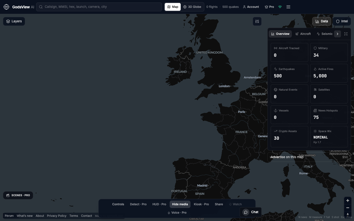
A live map brings many open feeds into one view so you can see whether they agree. On GodsView AI, for example, free layers include aircraft positions from ADS-B networks (OpenSky Network first, with adsb.lol and adsb.fi as fallbacks), AIS ships, CelesTrak satellite orbits, USGS earthquakes and NASA FIRMS fire detections. The full list of feeds and refresh rates is on our methodology page.
The Ops Center goes a step further: it merges reports of the same event from many sources into one incident and scores it from 0 to 100, which is useful for triage. It is a starting point for questions, not a verdict. If you want a side-by-side of the hosted and self-hosted options, see our roundup of the best live OSINT maps.
Is OSINT legal?
Collecting and analyzing public information is generally lawful, but "public" does not mean "anything goes." Laws on privacy, data protection, harassment, computer misuse and radio reception still apply, and they differ by country.
A few principles hold almost everywhere:
- Do not break in. Guessing passwords, bypassing paywalls or logins you are not entitled to, or using leaked credentials is outside OSINT.
- Do not deceive. Creating fake identities to get into closed groups raises legal and ethical problems that most newsrooms forbid without senior approval.
- Personal data is still personal data. In the EU, the GDPR defines personal data to include location data and online identifiers (Article 4), and collecting it for your own research does not remove those obligations.
- Do not use findings to stalk or intimidate. In the US, the federal stalking statute, 18 U.S.C. § 2261A, covers using electronic communication services to place someone under surveillance with intent to harass or intimidate.
Flight and ship tracking raise their own questions, including privacy programs that let aircraft owners limit what trackers display. We cover those in is flight and ship tracking legal?. This article is general information, not legal advice.
What are the ethics of OSINT?
Legal is the floor, not the ceiling. The Berkeley Protocol stresses protecting the digital, physical and psychosocial safety of investigators, witnesses, victims and first responders. In practice that means:
- Minimize harm. Blur faces of bystanders and victims, and do not publish details that could identify vulnerable people.
- Avoid private individuals as targets. Researching institutions, public officials acting in their public role, and events is different from profiling a private person.
- Mind operational security. Publishing the live position of a military unit, an aid convoy or a rescue team can put people in danger.
- Be transparent about uncertainty. State your confidence and show your evidence chain so others can check it.
- Look after yourself. Graphic content takes a toll; rotate tasks and use blur-by-default settings when you can.
For reporters applying these rules under deadline pressure, our guide to using a live map for journalism walks through a newsroom workflow.
What OSINT cannot tell you
Open sources are powerful and incomplete. Being clear about the gaps is part of doing it well.
| Limit | Why it happens | What to do |
|---|---|---|
| Missing aircraft | Some aircraft fly without ADS-B or with privacy programs; receiver coverage is thin over oceans and remote areas | Treat absence as "not seen," never "not there" |
| Dark or spoofed ships | AIS can be switched off or falsified | Cross-check with imagery and port records |
| Delayed or wrong reports | Early reports in a crisis are often inaccurate | Wait for corroboration and timestamps |
| Selection bias | Events with cameras and connectivity get documented; others do not | Note which areas you cannot see |
| Machine-coded noise | Automated news-event datasets can misplace or duplicate events | Open the underlying article before relying on a point |
Conflict mapping has its own set of traps, from propaganda to delayed frontline updates. Our explainer on how live conflict maps work covers how those maps are built and how to read them responsibly.
How to start learning OSINT
You can build real skill with free resources and a few weekly exercises:
- Pick a narrow question each week. For example: which aircraft types used a given airport today, or which ships are waiting outside a port?
- Practice geolocation. Take a photo from a news story and find its exact location using satellite and street-level imagery.
- Learn the signals. Understanding how ADS-B, AIS and orbital data work stops you from misreading a map. Start with how to track a flight.
- Keep an evidence log. Record URL, capture time in UTC, archive link and what you concluded.
- Read published investigations. Follow how experienced teams show their working, then try to reproduce one step.
Live maps make step 1 easier because the data is already on screen. The global intelligence map and live world map pages show what each layer offers.
Explore the global intelligence map
The short version
OSINT is a method, not a website. It starts with a clear question, uses information anyone can lawfully access, and earns trust through preservation, verification and transparent reasoning. Live maps of flights, ships, satellites and hazards are valuable corroboration because they come from independent sensors, but each layer has gaps you need to state.
Stay within the law, protect the people in your material, and treat every early report as a lead to check. For safety decisions during an emergency, follow official agencies rather than any map.
Frequently asked questions
What is OSINT in simple terms?
OSINT, or open-source intelligence, is the practice of answering a specific question using information anyone can lawfully access, such as news, public records, satellite imagery, social media and public radio broadcasts like ADS-B and AIS. The difference from casual searching is method: you collect against a question, preserve your sources, verify them independently, and state your confidence.
Is OSINT legal?
Gathering and analyzing public information is generally lawful, but privacy, data protection, harassment, computer misuse and radio laws still apply and vary by country. Accessing accounts without permission, using leaked credentials or stalking someone is not OSINT. Read our legal overview of flight and ship tracking, and consult a lawyer for your specific situation; this is not legal advice.
What are examples of OSINT sources?
Common sources include news reports, public social media posts and videos, satellite and street-level imagery, company and court records, aircraft ADS-B and ship AIS broadcasts, satellite orbit data, seismic readings and satellite fire detections. Live maps such as the GodsView OSINT map combine several of these feeds so you can check whether independent sources agree.
What is the Berkeley Protocol?
The Berkeley Protocol on Digital Open Source Investigations is a guide to professional standards for identifying, collecting, preserving, verifying and analyzing digital open-source information. It was developed by the Human Rights Center at UC Berkeley with the UN Office of the High Commissioner for Human Rights and launched in December 2020. It also stresses safety for investigators, witnesses and victims.
Do you need special software to do OSINT?
No. Many investigations use a web browser, free satellite imagery, reverse image search, an archiving service and a spreadsheet for an evidence log. Curated directories such as the Bellingcat Online Investigations Toolkit list hundreds of free tools. Live maps help with corroboration, but the core skill is careful method rather than any particular software.
Sources
- ODNI — The IC OSINT Strategy 2024–2026
- UC Berkeley Human Rights Center — Berkeley Protocol on Digital Open Source Investigations
- FAA — ADS-B Privacy
- IMO — AIS transponders
- Bellingcat — Online Investigations Toolkit
- Internet Archive — Save pages in the Wayback Machine
- InVID project — Verification Plugin
- GDPR Article 4 — Definitions
- 18 U.S.C. § 2261A — Stalking (LII)