Guide
How to Track the ISS in Real Time From Your Location
A real-time ISS tracker answers two different questions: where the station is right now, and when you can see it from where you stand. Here is how to get both, and how to tell them apart.
Key takeaways
- A real-time ISS tracker shows a computed position. It comes from published orbital elements, not from a live GPS feed sent by the station.
- The ISS circles Earth about every 90 minutes, 16 times a day, at 370 to 460 km up, on an orbit inclined 51.6 degrees.
- The ground track tells you where the station is. A visible pass needs three things at once: the station above your horizon, the station in sunlight and your sky dark.
- NASA Spot the Station and Heavens-Above give pass times for your location. Transit finders predict the rare moments it crosses the Sun or the Moon.
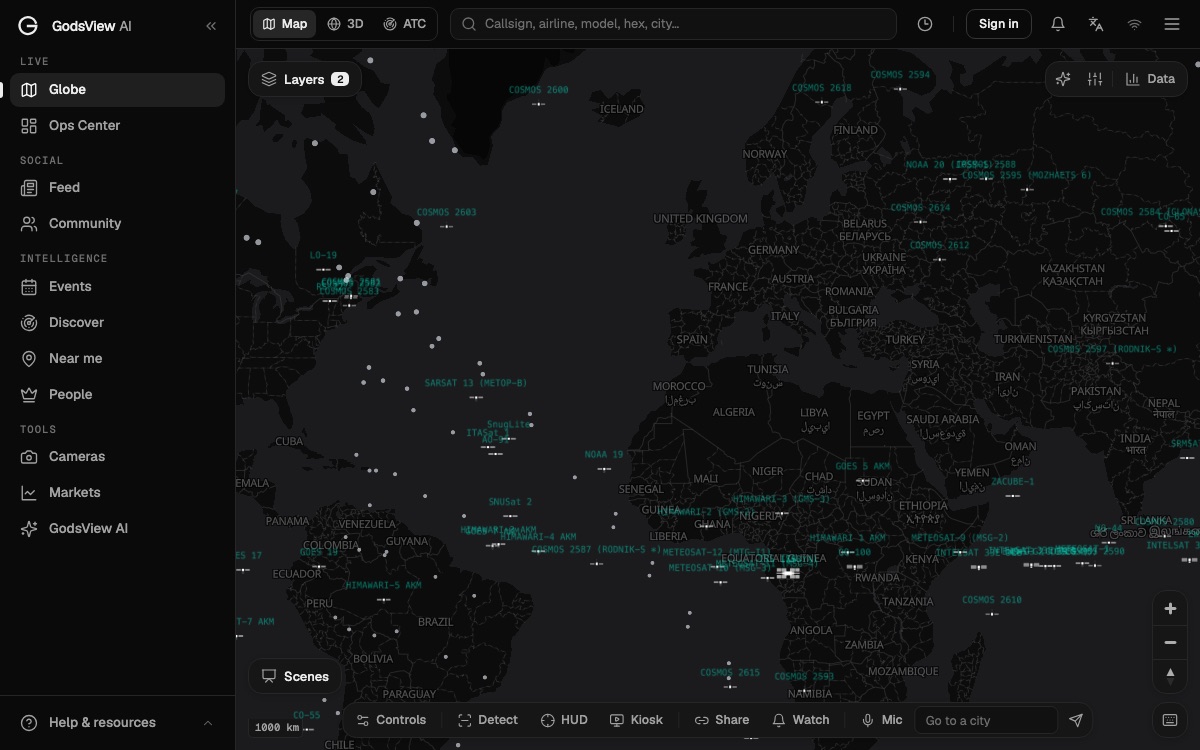
- On GodsView, the ISS tracker follows the station on a 3D globe, and the What's overhead page lists the satellite passes over you in the next 24 hours.
To track the ISS in real time, open a live tracker such as the GodsView ISS tracker, which shows where the International Space Station is right now on a 3D globe. To see it with your own eyes, you need a second piece of information: the pass times for your location. NASA's Spot the Station, Heavens-Above and the GodsView What's overhead page give you those. The live map tells you where it is. The pass list tells you when to step outside.
People often mix these up. A tracker can show the station right above your country at 2 pm, and you still won't see it, because the sky is bright. This guide explains how the orbit works, why some passes are visible and most are not, which sites to use for each job, and how to catch the station crossing the face of the Sun or the Moon.
See where the ISS is right now
Where is the ISS right now?
The quickest answer is a live map. On the ISS tracker, the globe opens on the station and follows it as it moves. The ISS satellite page gives the latest position as latitude and longitude, plus altitude and speed when the public position service returns them.
That position is a calculation. The station does not stream its GPS location to the public. Trackers download the latest published orbital elements for the ISS (its catalog number is 25544) and run them through a standard model to work out where it should be at this second. GodsView loads those elements from CelesTrak and refreshes them hourly. The mathematics is covered in how satellite tracking works, so this guide sticks to the practical side.
For a map, the calculation is plenty accurate. The station's height changes slowly, and controllers raise it from time to time with engine burns. A tracker using fresh elements stays close to the truth. One using data that is days old can be off by a noticeable amount, especially right after a reboost.
How the ISS orbit works
A few numbers explain almost everything about when and where you can see the station.
| Fact | Value | Why it matters |
|---|---|---|
| Altitude | 370 to 460 km | Low enough to be bright, high enough to catch sunlight after sunset |
| Time per orbit | About 90 minutes | You can get two or more passes in one evening |
| Orbits per day | 16 | Its path shifts west on each lap |
| Speed | About 5 miles (8 km) per second | A pass lasts minutes, not hours |
| Inclination | 51.6 degrees | Sets how far north and south it flies |
| Crew | Usually seven | Continuously occupied since November 2000 |
The altitude range and inclination come from NASA's ISS reference page. The 90-minute orbit, 16 orbits a day, five miles per second and seven-person crew are from NASA's facts and figures page.
Inclination: who can see it
Inclination is the angle between the orbit and the equator. At 51.6 degrees, the station's ground track swings between 51.6 degrees north and 51.6 degrees south. NASA says that inclination lets the station fly over 90% of the inhabited Earth.
Because the station is 400 km up, it can be seen from places a little beyond those latitudes, but it never passes straight overhead there. North of 51.6 degrees it stays lower in the southern sky, and south of 51.6 degrees south it stays low in the northern sky. Pass predictors account for this, so if a site lists no passes for a high-latitude town, that is the reason.
Why the path moves each lap
The Earth turns under the orbit. While the station makes one lap of about 90 minutes, the planet rotates by roughly a sixteenth of a turn. So each ground track starts further west than the one before. On a flat map, that produces the familiar sine-wave pattern that slowly drifts across the continents. It is also why passes over your town cluster into runs of a few days, then stop for a while.
Ground track vs visible pass: what a real-time map can't tell you
The ground track is the line on the Earth directly beneath the station. A live tracker draws it and moves a dot along it. The visible pass is a different thing. It is a window of a few minutes when you, standing at a given spot, can look up and see the station move across the sky.
Three conditions have to line up for a visible pass:
- The station is above your horizon. It doesn't have to pass over your town. It only has to come within view, which can happen when the ground track is hundreds of kilometers away.
- The station is in sunlight. The ISS makes no light of its own. You see sunlight reflecting off its solar panels and modules.
- Your sky is dark. In daylight, the station is lost in the glare.
NASA's Spot the Station explains that sightings happen within a few hours before or after sunrise or sunset. That is when the sky at your location is dark, but the station, 400 km up, is still lit by the Sun. In the middle of the night, it usually passes through Earth's shadow and goes dark.
This is why a dot on a map is not enough. The station might cross your region four times in a day and give you no visible pass at all. Our guide to seeing Starlink satellites tonight shows the same rule at work for other satellites, with a worked example from New York.
How to find ISS pass times for your location
You have several good free options. They use the same orbital data, so their times should agree to within a minute or so.
NASA Spot the Station
Spot the Station is NASA's official app and website for ISS sightings. NASA says it is available worldwide, in several languages, and covers most inhabited locations. For each sighting it lists:
- Time: when the sighting begins, in your local time zone.
- Duration: how long the station is visible.
- Maximum height: the highest point in degrees above the horizon (90 is straight up).
- Appears and Disappears: the compass directions where it enters and leaves your view.
You can also sign up for notifications, which is the easiest way to catch passes without checking every day.
Heavens-Above
Heavens-Above has been a favorite of amateur astronomers for years. Once you set your observing location, it gives 10-day predictions for the ISS and other bright satellites, a live sky chart, an interactive 3D view of the ISS orbit and a page showing the station's height over time. Its pass tables also include brightness in magnitudes, where a lower number means brighter.
GodsView: What's overhead and city pages
The GodsView What's overhead page uses your location to list the aircraft near you and the bright satellite passes in the next 24 hours, including the ISS, China's space station and the Hubble Space Telescope. For each pass, it shows rise and set times, the compass directions, and the highest elevation. A pass gets a Visible label only when the satellite is in sunlight while your sky is dark. Otherwise it reads In shadow or Daylight.
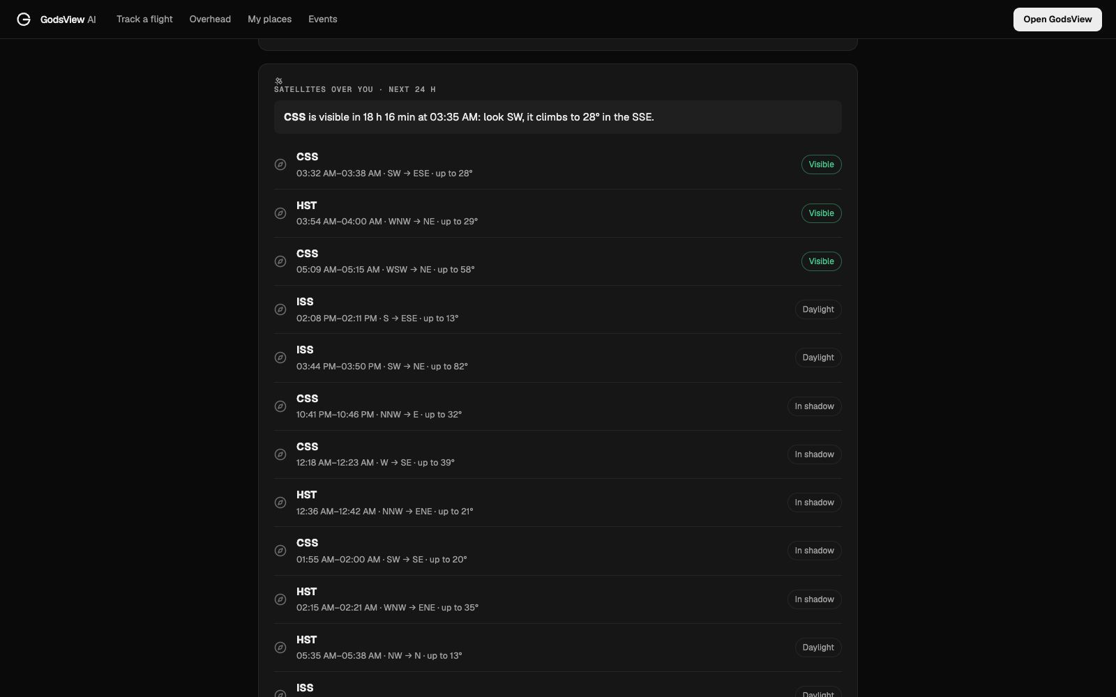
City pages such as planes over London and planes over New York show the same satellite pass list for that city, so you can bookmark one and check it in a few seconds.
How to spot the ISS in the sky
Once you have a pass time, the rest is easy. You don't need binoculars or a dark rural sky.
- Pick a good pass. A maximum height above about 40 degrees is easier to catch than one that skims the horizon.
- Go out five minutes early. Let your eyes adjust and find the direction where the station appears.
- Look for a steady, bright light. NASA describes it as looking like an airplane or a very bright star moving across the sky, but without flashing lights and without changing direction.
- Follow it across. It takes a few minutes to cross. On many passes it fades and disappears before it reaches the horizon, as it enters Earth's shadow.
If you see a light that blinks, it's an aircraft. A short streak that lasts a second is a meteor. The what was that light in the sky guide covers how to tell them apart.
A small tip: pass times can shift slightly when the station's orbit is adjusted. Check the time again on the day, especially for a pass a week away.
ISS transits: catching it in front of the Sun or Moon
An ISS transit happens when the station passes directly between you and the Sun or the Moon. Through a telescope or a camera with a long lens, you see the station's silhouette cross the disk. Photos of these transits are some of the most striking space images taken by amateurs.
Transits are very short. When Japan's National Astronomical Observatory photographed an ISS solar transit on November 3, 2015, the station crossed the Sun in less than a second. The observatory wrote a special program to take pictures at 30 frames per second and set a timer for the moment the transit started (NAOJ).
They are also very local. A transit is only visible from a narrow strip of ground. Move a short distance off that line and the station misses the Sun or Moon entirely. That is why transit hunters travel to the exact spot.
How to find a transit
Use a transit finder. The ISS Transit Finder asks for your location (latitude, longitude and elevation), a time span, and how far you are willing to travel. It then lists upcoming ISS transits of the Sun and Moon that you could reach. It can also search for transits by other satellites, including Hubble and China's Tiangong station.
Plan for:
- Exact timing. Sync your camera clock and start a burst or video a few seconds before the predicted time.
- Exact location. Stand on the centerline the finder gives you.
- Fresh predictions. Recheck the day before and the morning of the transit, because a reboost can shift the line.
Safety for solar transits
Never look at the Sun through a camera, telescope or binoculars without a proper solar filter on the front of the optics. NASA warns that eclipse glasses are not enough on their own behind optical devices, because the concentrated rays will burn through the filter and cause serious eye injury. Safe handheld viewers should meet the ISO 12312-2 standard (NASA eclipse safety). Lunar transits need no filter.
Which ISS tracker website should you use?
Each tool does one job well. Pick by the question you're asking.
| Question | Best tool | Cost |
|---|---|---|
| Where is the ISS right now? | GodsView ISS tracker or any live map | Free |
| When can I see it from home? | NASA Spot the Station, Heavens-Above, GodsView What's overhead | Free |
| Can I get a reminder before a pass? | Spot the Station notifications | Free |
| Will it cross the Sun or Moon near me? | ISS Transit Finder | Free |
| What else is in orbit around it? | GodsView live satellite tracker | Free |
| ISS pass layer on the globe | GodsView Plus | $10.99 a month or $99.99 a year |
GodsView's strength is context. The 3D globe can show the ISS next to other satellites, flights and world events on one map, and the space launch tracker shows the next crew or cargo launch to the station. Specialist pass sites remain the best tools for a single location.
Where real-time ISS data comes from
Every public tracker relies on the same chain:
- Measurement. The US Space Force tracks objects in orbit and maintains the public catalog, published on Space-Track.org.
- Distribution. CelesTrak republishes the data in groups such as "space stations". Most hobby and web trackers, including GodsView, read from it.
- Calculation. Your tracker runs the elements through the SGP4 model to compute the position for now and for future passes.
The data comes as two-line element sets (TLEs) or the newer OMM formats. If you want to check a tracker's freshness, look for the epoch of the elements it uses. The satellite tracking guide explains what each field in a TLE means and how prediction error grows as the data ages.
Open the live satellite tracker
Common questions about real-time ISS tracking
Why does my tracker show the ISS over the ocean when I just saw it? Live maps and pass lists can use different data or refresh at different times. A few seconds of delay is a large distance at 8 km per second.
Why are there no visible passes this week? Visible passes come in runs. When your local dusk and dawn don't line up with the station's path and sunlight, you can go days or weeks without one.
Can I see it from the city? Yes. The ISS is bright enough to see through city light. Clouds are the main problem.
Is the ISS the only space station? No. China's Tiangong station is also bright and appears on GodsView's Tiangong page and in the What's overhead pass list.
Frequently asked questions
How can I track the ISS in real time?
Open a live tracker such as the GodsView ISS tracker, which follows the station on a 3D globe. Its position is computed from the latest published orbital elements, which GodsView refreshes from CelesTrak every hour.
How do I find when the ISS passes over my location?
Use NASA Spot the Station, Heavens-Above or the GodsView What's overhead page. Each lists pass times for your location with the direction the station appears from, its maximum height and how long it is visible.
Why can I only see the ISS at dawn or dusk?
The station shines by reflected sunlight. You see it when your sky is dark but the station, about 400 km up, is still in sunlight. NASA says that happens within a few hours of sunrise or sunset.
How fast does the ISS orbit Earth?
NASA says the station travels about five miles per second and orbits Earth about every 90 minutes, making 16 orbits in 24 hours.
What is an ISS transit tracker?
A transit finder predicts when the station will pass in front of the Sun or the Moon from a given place. Transits last about a second and are visible only from a narrow strip of ground, so you need the exact time and location.
Can the ISS be seen from every country?
From most inhabited places. Its orbit is inclined 51.6 degrees, which NASA says lets it fly over 90% of the inhabited Earth. Far north or far south, passes are low or absent.
Sources
- NASA — International Space Station reference (altitude, inclination)
- NASA — Space station facts and figures
- NASA — Spot the Station
- Heavens-Above — satellite predictions
- ISS Transit Finder
- National Astronomical Observatory of Japan — ISS transiting the Sun (2015)
- NASA Science — Eclipse viewing safety
- CelesTrak — Current GP element sets
Facts checked on against each provider's own site.