How-to
Is There a Fire Near Me Right Now? How to Check Your Town
You see smoke over the hills, or a friend texts "is that a fire?". Here is the fastest way to find out what is burning, how close it is, and who can tell you whether to leave.
Key takeaways
- For a quick answer, open a satellite fire map for your city, then confirm with the official source: CAL FIRE in California, InciWeb for federal fires, and your county sheriff or emergency office for evacuations.
- A satellite hotspot is a hot pixel, not a confirmed wildfire. Farm burns, prescribed burns, factories and flares can all show up.
- Satellites pass over most places about twice a day, so a fire that started an hour ago may not be on any satellite map yet.
- Evacuation orders come from local authorities. In California, sign up for your county alert system through CalAlerts.org; Coconino County (Flagstaff) has its own sign-up.
- If you can see flames or smoke and no one has reported it, call 911. Do not wait for a map.
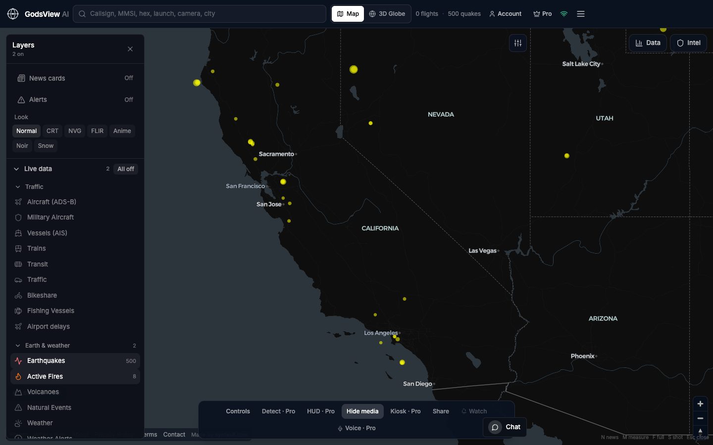
To check whether there is a fire near you right now, open a live fire map for your town, then confirm what you see with an official source: CAL FIRE's incident page in California, InciWeb for fires on federal land, and your county's emergency alerts for evacuations. If you can see flames or a new column of smoke and nobody has reported it, call 911 first. GodsView has a free wildfire page for each city, built from NASA satellite detections, that tells you the nearest fire, how far away it is, and which way the wind is pushing the smoke.
This guide covers how to check a specific town, which official sources to trust in California and Arizona, why a red dot on a satellite map is not always a wildfire, how to tell a house fire from a brush fire by the smoke, and how to sign up for evacuation alerts before you need them.
The fastest way to check for a fire near you
Do these in order. The whole thing takes two or three minutes.
- Look at a satellite fire map for your town. It shows heat detected from orbit in the last day or two. If there is a cluster of detections a few kilometres away, you know where to look next. If there is nothing, that is useful too, with the limits explained below.
- Check the official incident list. In California that is CAL FIRE's incidents page, which lists named fires with acres burned and containment. For fires on national forests and other federal land, check InciWeb, the interagency incident information system.
- Check your county's evacuation information. Evacuation warnings and orders come from the county sheriff and emergency services office, not from fire maps. Many California counties publish their zones on Genasys Protect, where you can type your address and see your zone and its status.
- Check local fire department and sheriff social accounts. For a small fire that started in the last hour, this is often the first official word.
If you want a single app that pulls a lot of this together, Watch Duty is a nonprofit that alerts on wildfires. Its staff and volunteers include current and retired dispatchers, firefighters and reporters who monitor radio scanners, cameras, satellites and official announcements, and post updates when there is a threat to life or property.
Checking a specific town: Redding, Manteca, Hayward, Irvine and more
Most people searching "is there a fire in [town] right now" want three things: is it close, is it growing, and do I need to do anything. Here is how that plays out for some of the towns people ask about most.
Redding. Redding sits at the north end of the Sacramento Valley, with brush and forest on three sides, so smoke on the horizon is common in summer and autumn. Start with wildfires near Redding to see satellite detections within 80 km, then check CAL FIRE's incident list and Shasta County's alerts. Shasta County replaced its CodeRED system with AlertShasta in 2024 and uses Genasys Protect evacuation zones (Shasta County).
Manteca. Manteca is in the flat farmland of San Joaquin County. A fire you see from town is more often a grass, field or structure fire than a forest fire. Check wildfires near Manteca, then San Joaquin County's alert system, SJReady Alerts, which you can join at sjready.org.
Hayward and Castro Valley. Both sit against the East Bay hills in Alameda County, where grass fires on the ridges can move fast in dry, windy weather. See wildfires near Hayward and wildfires near Castro Valley. Alameda County's official alert system is AC Alert, an opt-in service; the City of Hayward explains how to sign up for alerts by text, voice and email.
Irvine. Irvine borders open space and the foothills of the Santa Ana Mountains. Check wildfires near Irvine and sign up for AlertOC, Orange County's mass notification system, which the City of Irvine recommends for residents.
Fresno. Fresno is in the middle of the San Joaquin Valley, with the Sierra Nevada foothills to the east. Large fires in the mountains can send smoke over the city even when they are far away. Check wildfires near Fresno. The Fresno County Sheriff's Office runs a public evacuation map where you enter an address to see whether its zone is under a warning or order, and a free Everbridge alert sign-up.
Rancho Cucamonga. The city backs onto the San Gabriel Mountains, so a fire on the foothills can be very visible from town. Check wildfires near Rancho Cucamonga. San Bernardino County sends targeted phone and text warnings through its Telephone Emergency Notification System; the City of Rancho Cucamonga links to the sign-up.
Flagstaff. "Is Flagstaff on fire?" is a common search in spring and early summer, and the answer is often "no, it's a prescribed burn". Flagstaff is surrounded by ponderosa pine on the Coconino National Forest, which runs planned burns around the city and announces them in its newsroom. Check wildfires near Flagstaff, then the Arizona sources in the next section.
Official fire sources by state and county
Satellite maps tell you where heat is. These sources tell you what it is and what to do about it.
| Area | Fire information | Evacuations and alerts |
|---|---|---|
| California, statewide | CAL FIRE incidents (fire.ca.gov/incidents) | CalAlerts.org links to every county's alert system |
| Federal land, any state | InciWeb (inciweb.wildfire.gov) | County sheriff or emergency management |
| Shasta County (Redding) | CAL FIRE, Redding Fire Department | AlertShasta and Genasys Protect zones |
| San Joaquin County (Manteca) | CAL FIRE, local fire districts | SJReady Alerts (sjready.org) |
| Alameda County (Hayward, Castro Valley) | CAL FIRE, Alameda County Fire, Hayward Fire | AC Alert (acalert.org) |
| Orange County (Irvine) | CAL FIRE, Orange County Fire Authority | AlertOC (alertoc.org) |
| Fresno County | CAL FIRE, Fresno County Fire | Fresno Sheriff evacuation map and Everbridge alerts |
| San Bernardino County (Rancho Cucamonga) | CAL FIRE, San Bernardino County Fire | Telephone Emergency Notification System (TENS) |
| Arizona, statewide | Arizona Department of Forestry and Fire Management, wildlandfire.az.gov, InciWeb | Arizona Emergency Information Network |
| Coconino County (Flagstaff) | Coconino National Forest, Flagstaff Fire | County emergency notifications at coconino.az.gov/ready, evacuation zone map at coconino.az.gov/evacmap |
In California, Cal OES points everyone to calalerts.org, where you pick the county where you live or work and register for its alerts. You can sign up for more than one county.
In Arizona, the Department of Forestry and Fire Management handles fires on state and private land and points the public to its X account and Arizona InciWeb for updates. Coconino County runs a Ready, Set, Go! program and divides the county into evacuation zones; residents can look up their zone by address.
Why a satellite hotspot isn't always a wildfire
Satellite fire maps, including GodsView, show detections from NASA's VIIRS instruments. Each detection is a 375 m pixel that was hotter than its surroundings when the satellite passed over. That is a great way to see fires across a whole state at once, but heat is not the same as wildfire. Things that regularly show up as hotspots:
- Agricultural burns. Farmers burn crop residue, orchard prunings and field stubble. In the San Joaquin Valley, around Manteca and Fresno, the Valley Air District authorizes agricultural burns day by day through its smoke management system, so a permitted burn can look exactly like a new fire on a satellite map.
- Prescribed burns. Land managers burn on purpose to clear fuel. Around Flagstaff the Coconino National Forest burns hundreds or thousands of acres at a time in planned projects.
- Industrial heat. Refineries, steel works, power plants and gas flares are hot every night. A hotspot that sits in the same place for weeks is almost always one of these.
- Volcanoes and other hot surfaces. Rare in California towns, common elsewhere.
How to tell the difference: check whether the detection is new or has been there for days, whether it is on farmland or in the hills, and whether the official incident list has a named fire there. A named incident with acres and containment is a wildfire. A single low-intensity hotspot in a field with no incident is probably a burn.
The opposite problem matters more for safety: a satellite map can miss a real fire. VIIRS passes over most places about twice a day. A fire that starts after the last pass will not appear until the next one, and thick smoke or cloud can hide a fire from the sensor. Small fires, such as a single burning house or a roadside grass fire put out in 20 minutes, are often too small or too short to be detected at all. That is why "no fires within 80 km" on a satellite page means "nothing detected on the last passes", not "nothing is burning".
Our NASA FIRMS explainer goes deeper on pixel size, fire radiative power, confidence and data delay.
How to tell a structure fire from a wildfire by the smoke
You see smoke from your window. Before you start searching maps, a few observations narrow it down. None of these is proof, but together they are a good first guess.
- Where is it? Smoke rising from the middle of a neighbourhood or a commercial area is more likely a building, vehicle or dumpster. Smoke on a hillside, along a freeway shoulder or over open fields is more likely vegetation.
- What colour is it? Firefighter training material describes white smoke as typical of fires in their early stage and of moisture-laden fuels, brown or tan as wood in the early stages, and black as hydrocarbons and materials in later stages of burning (Fire Engineering). Thick black smoke inside a town often means plastics, fuel, tyres or a building. Grass and brush fires usually look lighter.
- What shape is it? A tight column that goes up from one point is typical of a single burning object. A wide, drifting plume that grows along a front is typical of vegetation.
- Is it changing? A structure fire usually stays in one place. A wildfire moves with the wind, and the smoke base gets wider over minutes.
- Can you hear sirens or see aircraft? Air tankers and helicopters dropping water mean vegetation fire. Ladder trucks heading into town mean a structure.
Then check. A structure fire almost never appears on a satellite map or on CAL FIRE's list, but it often appears on the local fire department's social accounts or in dispatch-based apps within minutes.
What the GodsView wildfire pages show
Each wildfires near your city page is built from NASA FIRMS VIIRS detections from the last 24 to 48 hours. GodsView groups detections that are within about 5 km of each other into one fire cluster and names it after the nearest city. A city page tells you:
- how many fire clusters are within 80 km, and the nearest one's distance and compass direction from the city centre
- each nearby cluster's number of detections, peak fire radiative power, and when it was first and last seen, in local time
- the current wind, gusts and humidity at the city, and which direction the smoke is drifting
- the official agencies to check for that state, and a reminder that evacuation orders come from local authorities
If nothing is close, the page tells you where the nearest detected fire is, up to 600 km away. State pages, such as wildfires in California, list every cluster in the state and every city with a detection within 80 km.
What it does not show: fire perimeters, containment, evacuation zones or road closures. GodsView sees heat from satellites, nothing more. Use it to know where to look, then confirm with the agencies above.
You can also see the fires on the live wildfire map, on the same globe as weather warnings and air quality.
Sign up for evacuation alerts before fire season
Evacuation orders are the one thing you cannot afford to miss, and most county systems are opt-in. If you have not signed up, you may not get a call or text.
- Register with your county. In California, go to calalerts.org and pick your county. In Coconino County, use the county's emergency notification sign-up. Add your home address, not just a phone number, because alerts are sent to the zones affected.
- Look up your evacuation zone. Many California counties and Coconino County publish zone maps. Write your zone down and save a screenshot, because zone names are what officials use in alerts.
- Turn on Wireless Emergency Alerts on your phone. These are the government alerts that arrive like an Amber Alert, with no sign-up.
- Learn the words. Cal OES defines an Evacuation Warning as a potential threat to life and property, when people who need extra time, including those with pets and livestock, should leave now. An Evacuation Order is an immediate threat to life and a lawful order to leave now. Shelter in Place means go indoors, shut doors and windows, and stay until told otherwise.
- Add family members' towns. If your parents live in Redding and you live in Irvine, sign up for both counties.
GodsView can also watch places for you. On My places, add a town and GodsView watches 50 km around it for wildfire alerts and satellite fire hotspots, along with earthquakes, severe weather and unhealthy air. Checking a place is free; saving watches and getting alerts needs a paid plan. Our guide to disaster alerts near home explains how it works. It is a second layer, not a replacement for your county's evacuation alerts.
When smoke reaches you but the fire is far away
Often the fire is 100 km away and the problem is the air. Smoke from Sierra Nevada fires regularly settles over Fresno and the Central Valley, and smoke from Northern California fires can reach the Bay Area.
Check the air quality in Fresno or your own city, and read our guide to what air quality index is bad. Keep windows closed when the AQI is high, run a HEPA air purifier if you have one, and limit time outdoors for children, older adults and anyone with heart or lung conditions.
A quick checklist
- See smoke or flames nobody has reported: call 911.
- Want to know what is burning: satellite fire map, then CAL FIRE or InciWeb.
- Want to know if you should leave: your county's alerts and evacuation zone map.
- Want to know if the air is safe: AQI for your city.
- Want to be told next time: sign up for county alerts now, and add your places on GodsView for a second layer.
Frequently asked questions
How do I find out if there is a fire near me right now?
Open a satellite fire map for your city, such as GodsView's wildfires by city pages, then confirm with the official source: CAL FIRE's incidents page in California, InciWeb for federal land, and your county's alerts for evacuations. If you can see an unreported fire, call 911.
Is there a fire in Redding right now?
Check wildfires near Redding for satellite detections within 80 km, then CAL FIRE incidents and AlertShasta for official information and evacuation alerts. GodsView does not show perimeters or evacuation zones.
Why does a fire map show a fire where nothing is burning?
Satellite fire maps show hot pixels, not confirmed wildfires. Agricultural burns, prescribed burns, refineries, power plants and gas flares all show up as hotspots. Check whether there is a named incident before assuming it is a wildfire.
Why is a fire I can see not on the map?
Satellites pass over most places about twice a day, so a new fire may not be detected until the next pass. Small or short fires, such as a house fire, are often never detected, and smoke or cloud can hide a fire from the sensor.
Is Flagstaff on fire?
Smoke around Flagstaff is often from planned burns on the Coconino National Forest, which it announces in its newsroom. Check wildfires near Flagstaff, then Arizona's wildland fire news and Coconino County's emergency notifications.
How do I get evacuation alerts in California?
Go to calalerts.org, choose your county, and register your phone, email and home address. Most county alert systems are opt-in, so you will not get calls or texts unless you sign up.
Sources
- CAL FIRE: Incidents
- InciWeb: About
- Cal OES: Evacuation warnings vs. evacuation orders
- Cal OES: Sign up for emergency alerts (CalAlerts.org)
- Watch Duty: How it works
- Shasta County: AlertShasta public warning system
- Fresno County Sheriff: Public fire mapping system
- Arizona Department of Forestry and Fire Management: Fire information
- Coconino National Forest: News releases
- San Joaquin Valley Air District: Burn authorization and approval
- Fire Engineering: Training bulletin, reading smoke
Facts checked on against each provider's own site.