Explainer
Submarine Cable Map: The Undersea Internet Explained
Almost all of the internet traffic that crosses an ocean travels through glass fibers lying on the seabed. Here is what a submarine cable map shows, how those cables are built and fixed, and what the recent cuts teach us.
Key takeaways
- TeleGeography tracks more than 600 active and planned submarine cables, with over 1.5 million km in service as of early 2026.
- Satellites carry only 0.37% of US international capacity, according to TeleGeography. The rest goes through cables.
- In the deep ocean a cable is about as wide as a garden hose. Near shore it is armored and usually buried under the seabed.
- There are roughly 200 cable faults a year. Fishing gear and dragged anchors cause about two-thirds of them.
- Recent cuts in the Red Sea (2024), the Baltic (2023 and 2024) and Tonga (2022) show how slow repairs can be when politics or geology get in the way.
A submarine cable map shows the fiber-optic cables that run along the seabed between countries and the landing points where they come ashore. These cables carry almost all intercontinental internet traffic. TeleGeography, the research firm that publishes the best-known cable map, tracks more than 600 active and planned cables, and says satellites account for just 0.37% of US international capacity.
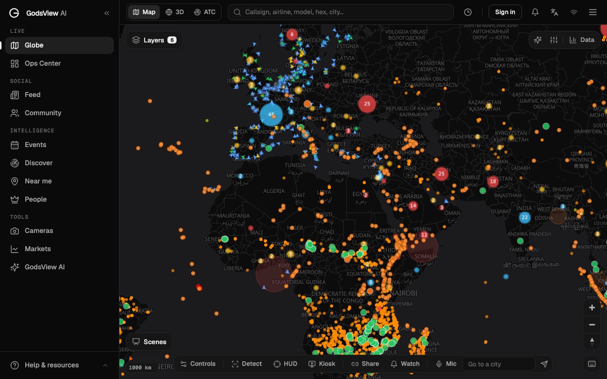
On GodsView, the submarine cable map draws major cable routes and landing points as a layer you can combine with live ships and internet outage data. This guide explains what is actually on the seabed, how cables are laid and repaired, who pays for them, and what happened in the cable cuts that made headlines.
What is a submarine cable?
A submarine cable is a bundle of optical fibers wrapped in protective layers and laid on, or buried under, the ocean floor. Light pulses carry data through the glass. Every few dozen kilometers, a repeater boosts the signal.
The numbers are smaller than most people expect. TeleGeography's cable FAQ says that for most of its journey across the ocean, a cable is typically as wide as a garden hose. A 2009 report by the International Cable Protection Committee (ICPC) and the UN Environment Programme gives the detail: deep-ocean cables are 17 to 21 mm across. Closer to shore, in water shallower than about 1,500 m, extra steel wire armor can bring the diameter to 40 to 50 mm (ICPC/UNEP report).
The same report describes modern repeaters. They use optical amplifiers, short lengths of fiber doped with the element erbium and energized by lasers. The typical spacing it gives is 70 km. The report also notes that the cable includes a copper conductor to power the repeaters.
How many submarine cables are there?
TeleGeography gives these figures in its FAQ:
| Measure | Figure |
|---|---|
| Active and planned cables tracked | More than 600 (as of 2026) |
| Total length in service | Over 1.5 million km (early 2026) |
| Satellite share of US international capacity | 0.37% |
| Cable faults per year | Roughly 200 |
| Faults caused by fishing and anchors | About two-thirds |
| Minimum design life | 25 years |
The headline point is the satellite share. People often assume intercontinental traffic goes through space. It doesn't. Satellites are vital for remote places, ships and aircraft, but for the bulk of the data flowing between continents, cables carry far more.
What a deep sea cable map shows, and what it doesn't
A deep sea cable map is a diagram, not a survey. The lines are generalized routes between landing points. The real cable snakes around seabed hazards, follows surveyed corridors and may sit in a trench under the mud near the coast. The exact position is known to the operators and to charting agencies, but public maps simplify it.
What you can learn from one:
- Which countries connect to which. A country with one or two cables is more fragile than one with dozens.
- Where cables bunch together. Some coasts host many landings within a short stretch, so one incident can hit several systems.
- Which chokepoints they share with shipping. Cables and shipping lanes often run through the same narrow seas, such as the Red Sea and the Strait of Malacca. Our guide to shipping chokepoints covers those passages from the ship side.
What you can't learn from one:
- Which cable carries your traffic. Internet routing changes constantly.
- Whether a cable is working right now. A drawn line stays on the map after a fault.
- The precise seabed position. Don't use a public map to plan anchoring or fishing; use official nautical charts.
Landing stations: where cables come ashore
At each end, a cable comes ashore at a landing point and runs to a cable landing station, a building that holds the equipment to power the cable and connect it to networks on land. From there, traffic flows to data centers and internet exchanges.
Landings tend to cluster in a few hubs. The GodsView cable layer marks major landing points such as Cornwall in the UK, Marseille in France, Singapore, Fujairah in the UAE, Mumbai and Chennai in India, Hong Kong and the Pacific coast of Japan.
How submarine cables are built and laid
Cables are made in long continuous lengths in factories, loaded into tanks on a cable ship and laid in one or two voyages. The ICPC/UNEP report notes that fiber cables are so much smaller than the old analog ones that a transatlantic lay now takes one or two voyages instead of four or five.
The laying process, as the report describes it:
- Route survey. The route is surveyed in advance to avoid hazards and to choose where to bury.
- Touch-down. The ship pays out the cable slowly until it reaches the seabed.
- Steady laying. The ship then speeds up to a practical maximum of about 11 to 15 km per hour, slowing to pass repeaters through the cable machinery. It pays out the cable slightly faster than it moves, 2 to 3% extra, so the cable follows the contours of the seabed.
- Burial near shore. From the coast down to about 1,000 to 1,500 m of water, cables are commonly buried to protect them from other seabed users. The most effective method is a sea plough towed behind the ship, which cuts a narrow furrow and inserts the cable. Sandy seabeds may need a plough with a water jet. Sections the plough has to skip, such as where the cable crosses another cable or pipeline, can be buried later by a remotely operated vehicle (ROV).
- Deep water. Below about 1,500 m, cables mostly lie directly on the seabed. The report links that depth to the present reach of bottom trawlers.
TeleGeography sums it up the same way: near shore, cables are buried under the seabed for protection, and in the deep sea they are laid directly on the ocean floor.
How undersea cables are repaired
Faults are routine. TeleGeography counts roughly 200 a year, and says accidents such as fishing vessels and ships dragging anchors account for two-thirds of them. Shark bites, a favorite myth, caused zero faults between 2007 and 2014 by its count.
The ICPC/UNEP report lists the basic steps of recovery:
- Locate the fault. The operator finds the faulted section, using tests from the shore stations.
- Grapple the cable. A repair ship tows specially designed grapnels along the seabed to catch the cable. Where it is buried, it may come up from 1 to 3 m below the seabed, which puts heavy strain on the cable.
- Lift and repair. The damaged section is brought to the surface. A new piece of cable is joined in, and the repaired cable is lowered back down.
- Rebury if needed. On the continental shelf or slope, the repaired section is buried again, usually with the help of an ROV.
Repair speed depends less on the work itself than on getting a ship there and getting permission to work. The two cases below show why.
Operators reduce the risk by spreading traffic across several cables. TeleGeography notes that countries spread their capacity across multiple cables so that if one breaks, the network keeps running.
Notable cable cuts
Tonga, January 2022
The Hunga Tonga-Hunga Ha'apai eruption and tsunami in January 2022 cut the cable connecting Tonga to the outside world. Radio New Zealand reported that the repair ship Reliance took 20 days to fix the cable, ran 24 hours of tests, and handed it back just before midday on February 22, 2022. The repair was estimated to cost at least US$1 million, and Tonga had only limited internet access for about a month (RNZ).
The lesson: a small country with a single international cable has no backup when that cable fails.
The Baltic Sea, October 2023
On October 8, 2023, the Balticconnector gas pipeline between Finland and Estonia had a sudden pressure drop, and two telecom cables were damaged: one between Estonia and Finland and one between Estonia and Sweden. Finnish police later said an anchor lifted from the seabed on October 24 could be considered to belong to the Hong Kong-flagged vessel Newnew Polar Bear, and that the same type of paint was found on the anchor and the damaged pipeline. At the time, they had not determined whether the damage was deliberate (ERR News).
The Red Sea, February 2024
In late February 2024, three cables in the Red Sea, Seacom, AAE-1 and EIG, were knocked offline. The cargo ship Rubymar had been attacked by Houthi forces and later sank. The general manager of the ICPC, quoted by gCaptain, said it was generally accepted that the Rubymar dropped an anchor when fired upon and damaged cables nearby. Hong Kong provider HGC Global Communications estimated the three cables carried about 25% of traffic in the region (gCaptain).
Repairs took months. gCaptain reported in July 2024 that AAE-1 was back online after negotiations with the two factions that control Yemen, and that the repair ship Niwa was staying on to fix Seacom and EIG (gCaptain).
The Baltic Sea, November 2024
At 4:04 am on November 18, 2024, the operator Cinia detected a fault in the C-Lion1 cable between Finland and Germany. The damage was in the Swedish exclusive economic zone, east of the southern tip of Öland, about 700 km from Helsinki. Cinia said the cause was unknown and asked Finland's National Bureau of Investigation to investigate. The repair ship Cable Vigilance left Calais on November 21 and reached the site on November 25 (Cinia).
| Incident | When | Cause as reported | What it shows |
|---|---|---|---|
| Tonga cable | January 2022 | Volcanic eruption and tsunami | One cable means no backup |
| Balticconnector and two telecom cables | October 2023 | Anchor linked by police to Newnew Polar Bear | Ships and anchors are the main risk |
| Seacom, AAE-1, EIG | February 2024 | Anchor of the sinking Rubymar | Conflict can delay repairs for months |
| C-Lion1 | November 2024 | Unknown, investigation requested | Cause can take a long time to establish |
Who owns submarine cables?
Cables are owned by telecom carriers, by groups of companies that share one system, and more and more by large internet companies. TeleGeography says content providers such as Google, Meta, Microsoft and Amazon are major investors in new cable. Those companies run data centers on several continents and move large volumes of data between them.
For a map reader, ownership matters when a fault happens. A cable shared by several owners needs all of them to coordinate on a repair. A cable damaged in a contested area, as in the Red Sea, may need permits from parties that are in conflict.
How to read cables on GodsView
The GodsView submarine cable map shows major cable routes and landing points as a layer. Routes are drawn approximately, so treat each line as context rather than a seabed position. The cable layer is part of GodsView Pro ($129.99 a month as of November 2026), along with data centers, internet exchanges from PeeringDB and internet outages from IODA.
Ways to use it:
- Start from a story. If news reports a cable fault, zoom to the landing region and see which routes pass through.
- Add ships. Turn on vessels from the live ship tracker to see what is moving along a cable route. The AIS explainer covers what that data can and can't show.
- Add outages. If a country goes offline, the outage layer shows whether connectivity dropped. Outages have many causes besides cables, so don't assume.
- Check the region. Saved views such as the Red Sea live map frame a hot spot quickly.
Why the undersea internet matters to you
Most of the time you never notice cables. When one fails, traffic reroutes and you might see slower pages to some destinations. When a country with few cables loses its link, as Tonga did, phone calls, banking and news can stop for weeks.
That is why a map of them belongs alongside ships, outages and news on an OSINT map. Understanding where the cables run, and how slowly they can be fixed, explains a lot about why some regions are more fragile than others.
Frequently asked questions
How many submarine cables are there?
TeleGeography says it tracks more than 600 active and planned submarine cables as of 2026, with over 1.5 million km of cable in service in early 2026.
How much internet traffic goes through undersea cables?
Almost all intercontinental traffic. TeleGeography says satellites account for just 0.37% of US international capacity; the rest travels through cables.
How thick is an undersea internet cable?
In the deep ocean about as wide as a garden hose, 17 to 21 mm according to an ICPC and UNEP report. Near shore, steel armor can bring it to 40 to 50 mm.
What usually breaks undersea cables?
People, mostly by accident. TeleGeography says fishing vessels and ships dragging anchors cause about two-thirds of the roughly 200 faults each year. Earthquakes and volcanic eruptions cause others.
How are undersea cables repaired?
A repair ship locates the fault, catches the cable with grapnels, lifts the damaged section, joins in new cable and lowers it back, reburying it near shore. Getting a ship and permits can take far longer than the repair itself.
Is there a live submarine cable map?
Cable routes don't change minute to minute, so maps show fixed routes. The GodsView submarine cable map lets you add live ships and internet outage data on top of the routes.
Sources
- TeleGeography — Submarine cable frequently asked questions
- ICPC, UNEP and UNEP-WCMC — Submarine cables and the oceans: connecting the world (2009)
- RNZ — The Southern Cross cable that connects Tonga to the outside world is fixed (February 2022)
- ERR News — Anchor found next to Balticconnector belongs to Newnew Polar Bear (November 2023)
- Cinia — A fault in the C-Lion1 submarine cable between Finland and Germany (November 2024)
- gCaptain — Rubymar anchor seen as likely cause of severed Red Sea cables (March 2024)
- gCaptain — Damaged subsea cables repaired in Red Sea (July 2024)
Facts checked on against each provider's own site.