How-to
Was That an Earthquake Just Now? How to Check in a Minute
The windows rattle, the floor moves, and the first thing everyone does is pick up a phone. Here is where to look, how long to wait before an earthquake shows up, and what the first numbers do and don't tell you.
Key takeaways
- Check a live earthquake list built on the USGS feed. Its past-hour and past-day feeds update every minute.
- USGS posts a California quake in about 2.5 minutes on average, one elsewhere in the US within about 8 minutes, and one outside the US in about 20 minutes.
- If nothing shows yet, wait a few minutes and check again. Outside the US, also check your national seismic agency and EMSC.
- Report what you felt to USGS "Did You Feel It?". If the quake is not listed yet, use "Report an Unknown Event".
- The first magnitude and location are estimates that can change as more data arrive, and a depth of exactly 10 km often means the depth was fixed, not measured.
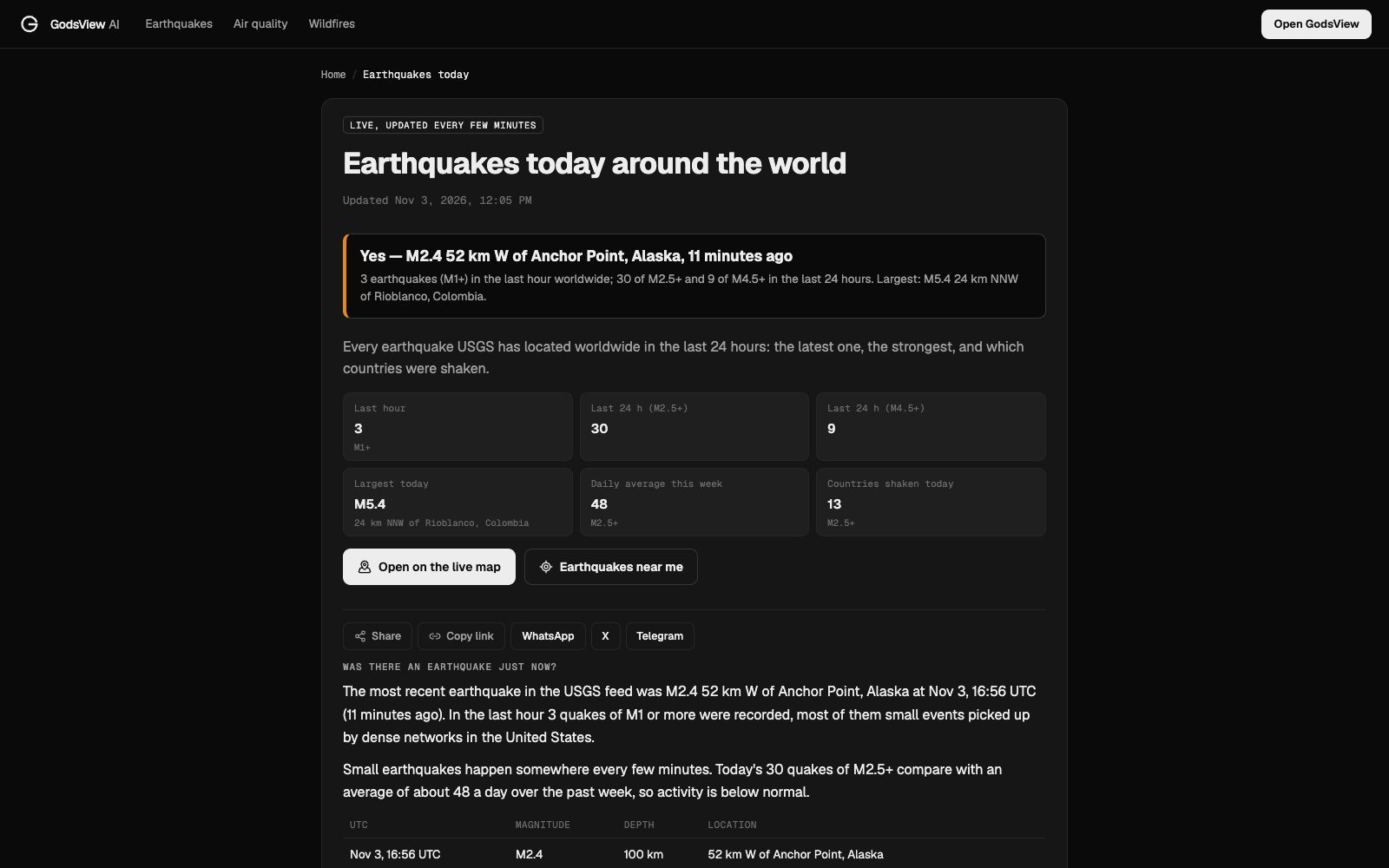
To check whether there was an earthquake just now, open a live list of earthquakes from the US Geological Survey and look at the last few minutes. On GodsView, the earthquakes today page answers the question at the top in plain words, "Yes" or "No", with the most recent quake, the largest of the day and how many there have been in the last hour. If you live in a city, earthquakes near your city narrows it to a 100 km radius.
Give it a few minutes, though. Seismic networks need time to locate a quake, and how much time depends on where you are.
Was there an earthquake just now?
Step 1: check the live list
The quickest answer comes from a page that reads the USGS earthquake feeds directly. USGS publishes feeds for the past hour, day, 7 days and 30 days, split into significant quakes, M4.5+, M2.5+, M1.0+ and all earthquakes, and every one of them is "updated every minute" (USGS feeds).
GodsView's earthquakes today page is built on those feeds. When I checked on November 3, 2026, it said: "Yes — M2.4 52 km W of Anchor Point, Alaska, 11 minutes ago", with 3 quakes of M1 or more in the last hour worldwide, 30 of M2.5 or more in the last 24 hours, and a largest of M5.4 in Colombia.
If you use the USGS feeds directly, pick the right one. The "significant" and M4.5+ feeds leave out smaller quakes, including ones you can feel if they are close. For a "was that an earthquake" check, the past-hour feed with all earthquakes, or M1.0+, is the one to open.
If you felt something, look for a quake close to you in the last few minutes, not just the biggest one on the page. A small, shallow quake nearby can feel stronger than a large one far away.
Step 2: check near your city
For a local answer, open the page for your nearest city. The Los Angeles page, for example, counts M2.5+ quakes within 100 km over the last 24 hours, 7 days and 30 days, shows the largest and nearest quakes, and lists the year's count within 150 km.
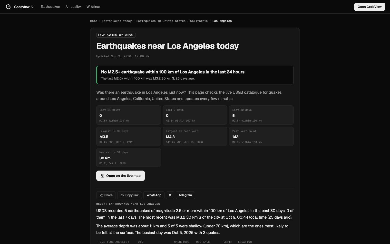
The answer box at the top is the part you want in the moment. "No M2.5+ earthquake within 100 km of Los Angeles in the last 24 hours" is clear. If it says yes, the table below gives the time in local time and UTC, the magnitude, the distance and the depth.
How long until an earthquake shows up?
This is the question behind most "earthquake just now" searches. You felt it, you checked, nothing is there. USGS gives average times for when a quake is processed and posted (USGS FAQ):
| Where the quake is | Average time to post | Why |
|---|---|---|
| California | About 2.5 minutes | The densest seismic network in the US |
| Elsewhere in the US | Within about 8 minutes | Networks are less dense |
| Outside the US | About 20 minutes | Data come from global stations and partner networks |
| Any web page | Up to 60 more seconds | Caching on the website |
| USGS email alerts | Several minutes to 45 minutes for a large quake | Large quakes trigger many notifications |
So if you felt shaking in Los Angeles a minute ago and nothing is listed, wait two or three minutes and refresh. In the rest of the US, give it up to ten. Outside the US, the USGS list may not show a small local quake at all; your national agency is the better source.
Step 3: check your national agency or EMSC
USGS lists quakes worldwide, but for a small local quake outside the US, the national network in that country is the more direct source. Good places to look:
- Your national seismic agency, such as the British Geological Survey, Japan Meteorological Agency, GeoNet in New Zealand or Geoscience Australia.
- EMSC, the European-Mediterranean Seismological Centre. Its LastQuake service detects felt earthquakes from people: when shaking is felt, a "rush of visitors" to its websites, app and social channels causes a sudden traffic spike, which "suggests the EMSC that a seismic event has probably occurred and been felt by the population" (EMSC). That can flag a felt quake before the seismic solution is finished.
If neither shows anything after 20 minutes, it may not have been an earthquake. Heavy trucks, building work and loud booms can shake windows too.
Step 4: tell USGS what you felt
Your report is useful data. USGS runs "Did You Feel It?", a citizen-science survey that builds maps of shaking from people's answers. USGS says the best way is to click the earthquake you think you felt on its list and choose "Tell Us!". If you don't see it, use the "Report an Unknown Event" button. "Maps and graphs are produced from the responses in real-time" (USGS FAQ).
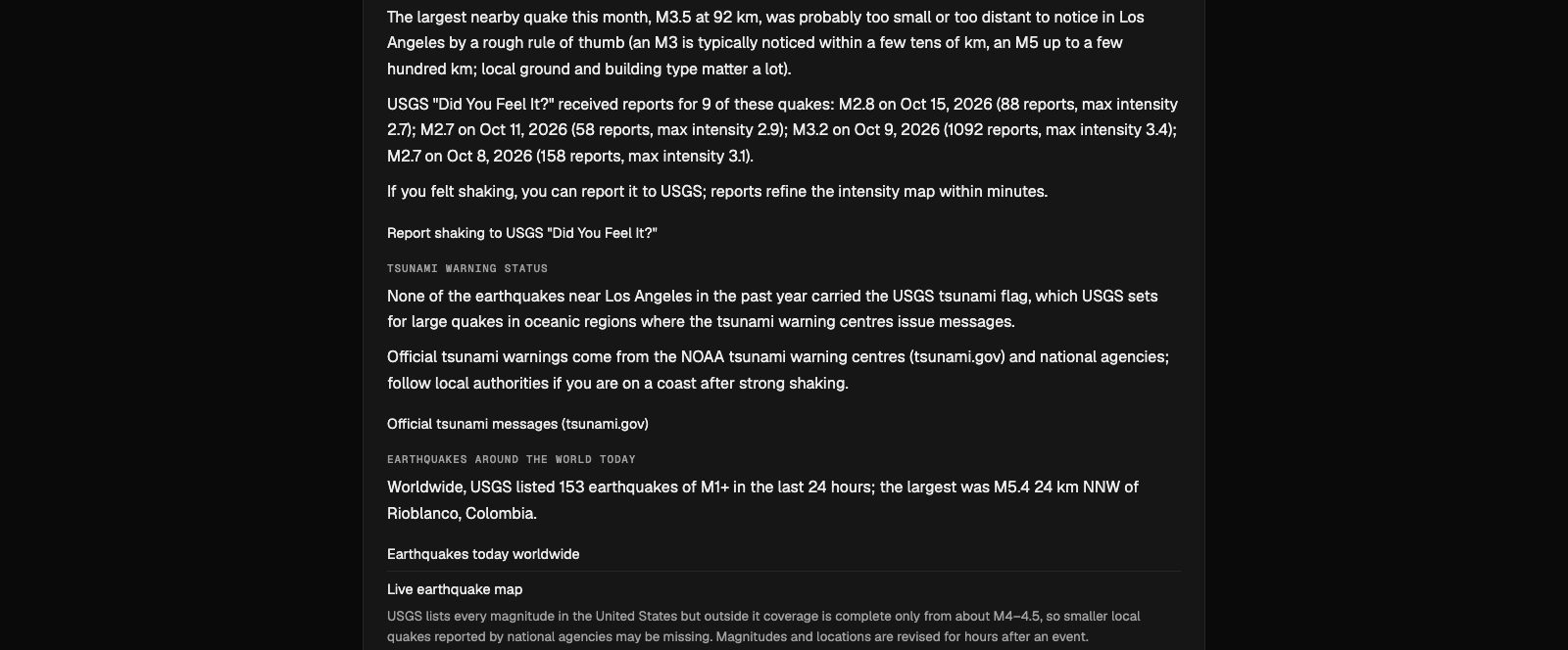
GodsView's city pages show how many reports a recent quake received. On the Los Angeles page, an M3.2 on October 9, 2026 had 1,092 reports and a maximum intensity of 3.4, while smaller nearby quakes had dozens.
Read the first numbers with care
The first report of a quake is an estimate. Treat it like a first draft.
- Magnitude changes. The first magnitude is automatic and often moves up or down as more data come in. GodsView's city pages note that magnitudes and locations are revised for hours after an event.
- Location shifts. The epicentre can move as more stations are added to the solution.
- Depth of exactly 10 km. USGS explains that 10 km is often a "fixed depth": when the data are too poor to compute a reliable depth, the depth is set to 10 km because reliable depths in many areas average close to that (USGS FAQ).
- "Near" place names. "52 km W of Anchor Point" is a reference to the nearest named place, not where the damage is.
For a fuller walkthrough of magnitudes, depth, ShakeMaps and the PAGER alert, read how to read an earthquake map.
What to do after you feel an earthquake
Checking the map comes second. If the shaking was strong:
- Stay clear of damage. The US Tsunami Warning Centers advise avoiding fallen power lines and staying away from weakened structures (tsunami.gov). Aftershocks can bring down things that are already loose.
- On a coast, think tsunami. If you feel strong shaking near the coast, the warning centres say not to wait for an official warning: move to high ground or inland as soon as you can do so safely. GodsView's city pages show whether recent nearby quakes carried the USGS tsunami flag and link to official messages at tsunami.gov, but official warnings come from the tsunami warning centres and national agencies.
- Check on people near you, then check the news. The live news map and world events pages pick up reports quickly after big quakes.
How to get an alert next time
Searching after the fact works, but an alert is better. GodsView's My places watches a 50 km circle around each place you add and alerts on earthquakes of magnitude 4.5 or higher, along with severe weather, floods, wildfires and bad air. Alerts need a paid plan; the alerts tutorial shows the setup step by step, and how to get disaster alerts near home compares the options.
Frequently asked questions
Was there an earthquake just now?
Check earthquakes today. It reads the USGS feeds, which update every minute, and says at the top whether there has been a recent quake, where, and how long ago.
Why is the earthquake I felt not on the map?
It may not have been processed yet. USGS posts a California quake in about 2.5 minutes on average, other US quakes within about 8 minutes and quakes outside the US in about 20 minutes. Small quakes outside the US may only appear on your national agency's list.
How do I report an earthquake I felt?
Use USGS "Did You Feel It?". Click the quake on the USGS list and choose "Tell Us!", or use "Report an Unknown Event" if it is not listed yet.
Why did the magnitude change?
The first magnitude is an automatic estimate. It is revised as more data come in, sometimes for hours after the quake.
Why do so many earthquakes show a depth of 10 km?
Because 10 km is often a fixed depth. When the data are too poor to compute a reliable depth, USGS assigns 10 km.
How can I check for earthquakes near me?
Open the earthquakes near page for your city, or use the Earthquakes near me button on earthquakes today, which finds your nearest city.
Sources
- USGS: How quickly is earthquake information posted to the USGS website?
- USGS: Real-time earthquake feeds (GeoJSON summary)
- USGS: Did I feel an earthquake? Can I report feeling an earthquake?
- EMSC: How the LastQuake system works
- US Tsunami Warning Centers: Tsunami FAQ (tsunami.gov)
Facts checked on against each provider's own site.