Guide
God's Eye View Satellite Live: Watch Earth From Above Now
A live satellite view of the whole planet is the classic god's-eye view. Here is what you can really watch from orbit today, how old each picture is, and where to open it in a browser.
Key takeaways
- There is no public, continuous live video of the whole Earth from a satellite. The closest thing is weather-satellite imagery, refreshed about every 10 minutes for each hemisphere.
- GOES (Americas), Himawari (Asia-Pacific) and Meteosat (Europe and Africa) photograph their side of the planet every 10 to 15 minutes. That is the "live" in most live satellite maps.
- Sharp pictures of a single street come from satellites such as Sentinel-2 (10 m pixels, a new pass about every 5 days) and Landsat (30 m, about every 8 days). They are days old, not live.
- On GodsView, a free account shows the Satellite clouds layer, live satellite positions and hazards on one globe. The Satellite tool with Sentinel-2, Landsat, radar and history is part of the paid plans.
- No satellite service, free or paid, lets the public watch a person, a car or a house in real time.
You can't watch a live video of the whole Earth from a satellite, but you can get close. Weather satellites photograph each side of the planet about every 10 minutes, so a "live" satellite view shows clouds, storms and smoke that are minutes old. Sharper pictures, where you can make out fields, roads and buildings, come from Earth-observation satellites that pass over the same place every few days. GodsView puts the minutes-old cloud imagery, the satellites themselves and live hazards on one globe: open the God's eye view of the world, live to see it.
This guide explains what each kind of "live satellite" view really shows, how old each picture is, which sources are free, and how to read them without being fooled. It also covers the hard limit: no public satellite can follow a person or a car in real time.
What "live" means for a satellite view of Earth
Search for "god's eye satellite live" and you will find maps, apps and videos that promise a real-time picture of the planet. Three very different things hide behind the word "live":
- Weather-satellite imagery. Geostationary satellites sit about 35,800 km above the equator and stare at the same half of the Earth all the time. They send a new full picture of their hemisphere every 10 to 15 minutes. This is the freshest whole-Earth picture the public can see.
- Earth-observation imagery. Satellites in low orbit, such as Sentinel-2 and Landsat, fly a few hundred kilometers up and take much sharper pictures, but only of a strip of ground at a time. The same place is photographed every few days, and only cloud-free passes are useful.
- Satellite positions. A "live satellite tracker" shows where satellites are right now, computed from their published orbits. It shows the satellites, not pictures taken by them.
Most "live satellite view" pages mix two or three of these. Knowing which one you are looking at tells you how old the picture is.
| What you see | Typical source | How fresh | Detail per pixel | Free to view? |
|---|---|---|---|---|
| Clouds, storms, smoke over a hemisphere | GOES, Himawari, Meteosat | About 10–15 minutes | 0.5–2 km | Yes |
| Whole-Earth true-color picture | NASA MODIS and VIIRS (Worldview) | Yesterday, sometimes hours | 250 m–1 km | Yes |
| Fields, rivers, burn scars, new roads | Sentinel-2 | A pass about every 5 days | 10 m | Yes |
| Forty years of change | Landsat | A pass about every 8 days | 30 m (15 m panchromatic) | Yes |
| Through clouds and at night | Sentinel-1 radar | Every few days | About 10 m | Yes |
| Cars and rooftops | Commercial satellites, aerial photos | Days to years; on request | 30 cm–1 m | Mostly paid or in map basemaps |
| Satellites themselves moving | Orbital elements (TLEs) | Computed every second | Not an image | Yes |
How weather satellites give a near-live view
The weather satellites are the backbone of every live satellite map.
- GOES-East and GOES-West (NOAA) cover the Americas and the Pacific. Their Advanced Baseline Imager captures a full-disk image every 10 minutes, the continental United States every 5 minutes, and one or two smaller areas, such as a hurricane, every 30 to 60 seconds.
- Himawari-9 (Japan Meteorological Agency) covers East Asia, Australia and the western Pacific with a full-disk image every 10 minutes.
- Meteosat (EUMETSAT) covers Europe, Africa, the Middle East and the Indian Ocean.
By day these satellites see visible light, so clouds look like clouds and smoke looks like smoke. At night they switch to infrared, which shows how cold the cloud tops are, not what they look like. That is why a live satellite map often looks grayer and flatter after dark.
On GodsView, the Satellite clouds layer composites these geostationary satellites into one picture of the planet: visible imagery where it is daytime, infrared where it is night, refreshed every 10 minutes. Turn it on in Layers and add Storm tracks, Active fires or Earthquakes on top. It is the quickest way to answer questions such as "is that storm going to reach the coast?" or "is this haze smoke or cloud?".
What the sharpest free satellites show, and how old it is
When people imagine a god's-eye satellite view, they usually picture zooming in on a town and seeing it as it is right now. The free satellites that can do that kind of detail are not live.
- Sentinel-2 (European Union's Copernicus program, operated by ESA) has four bands at 10 m per pixel and photographs the same place about every 5 days. A 10 m pixel is enough to see fields, rivers, large buildings, airport runways and burn scars. It is not enough to see a car.
- Landsat 8 and 9 (NASA and USGS) photograph every place about every 8 days between them, at 30 m per pixel, with a 15 m panchromatic band. New scenes are usually available within hours of the pass. The Landsat archive goes back to the 1970s and 1980s, which makes it the standard tool for seeing how a place changed.
- Sentinel-1 is a radar satellite. Radar sees through clouds and works at night, so it is used for floods and sea ice. Water shows up dark.
Clouds are the main limit. A pass on a cloudy day shows only the tops of the clouds, so the newest clear picture of your town might be weeks old in a rainy season.
The GodsView Satellite tool
GodsView's Satellite tool, at godsviewai.com/world/satellite, opens these sources in one viewer: Sentinel-2, Landsat, Sentinel-1 radar, US aerial photography (NAIP, 60 cm, roughly every two years), NASA daily whole-Earth pictures since 2012, and a "Live weather" view of the last six hours of geostationary imagery. You can compare two dates with a swipe, chart plant health, water or burn indices over time, and play a time-lapse. The Satellite tool is part of the paid plans (Plus and Pro); a free account gets the cloud layer, satellite positions and hazards on the main map. Imagery is credited to Copernicus Sentinel data, Landsat (USGS) and NAIP (USDA) via Microsoft Planetary Computer.
Can a satellite show my house live?
No public service shows a house, a person or a car live from space, and none of the services in this guide can track people.
- The detailed pictures in Google Maps, Apple Maps and similar apps are mostly aerial photos and commercial satellite images taken months or years earlier and stitched into a mosaic.
- Commercial satellites can resolve about 30 cm, enough to see a car, but they photograph a place when a customer orders it or when the satellite passes, not continuously.
- Geostationary weather satellites, the only ones that look at the same place all the time, see 0.5 to 2 km per pixel. A whole neighborhood fits in one pixel.
If you are curious where the film idea of a "God's Eye" that finds anyone ends and real technology begins, read is God's Eye real. For what flights and ships broadcast about themselves, see is flight and ship tracking legal.
Watching Earth from the space station
The one place you can watch moving video of Earth from orbit is the International Space Station. NASA and partner agencies such as the Canadian Space Agency stream live views from cameras on the station when a feed is available. The station is about 400 km up and circles the Earth roughly every 90 minutes, so the view sweeps quickly from ocean to coast to cloud. Half of each orbit is on the night side, where the video is black apart from city lights and lightning, and the feed sometimes switches to an inside camera or drops out.
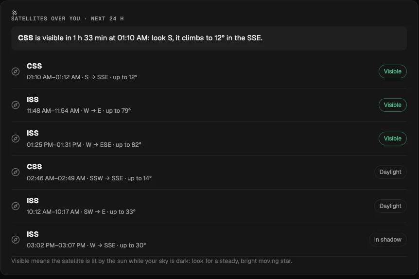
To know when the station is over you, or to look up and see it with your own eyes, use the ISS tracker guide or GodsView's What's overhead page, which lists visible passes for your location without signing in.
See the satellites themselves, live
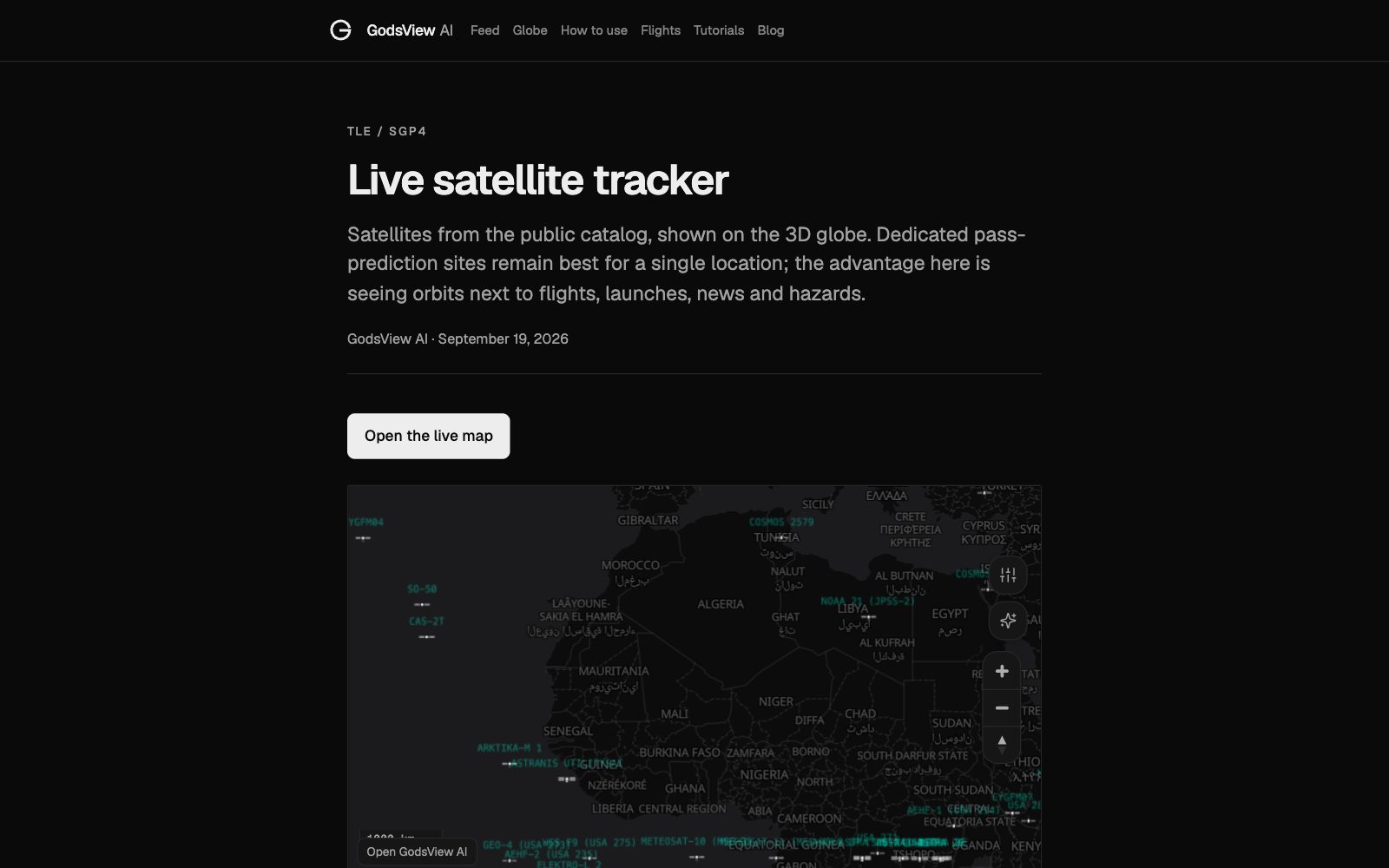
A different kind of god's-eye satellite view is to watch the satellites move. GodsView's live satellite tracker shows satellites from the public catalog on the 3D globe, with positions computed from CelesTrak orbital elements using the SGP4 model. You can find the ISS, the Chinese space station, Hubble, GPS satellites and Starlink trains next to live flights and world events. These are predictions from published orbits, accurate to well within what a map can show, but not radar tracks. The how satellite tracking works guide explains the method and its limits.
How to get a live satellite view on GodsView
- Go to godsviewai.com/globe in any browser, or open the free GodsView AI app on iPhone or Android.
- Sign in with a free account. No card is needed.
- Open Layers and turn on Satellite clouds. Zoom to your region.
- Add Storm tracks, Active fires and Earthquakes to see what the clouds are doing near hazards.
- Turn on Satellites to see what is in orbit above you.
- On Plus or Pro, open the Satellite tool from the menu for Sentinel-2, Landsat and radar pictures of any place, with dates you can compare.
The free plan has banner ads and pauses continuous live viewing after 30 minutes; reload to continue. Plus costs $10.99 a month or $99.99 a year and removes both, adds the Satellite tool, photoreal 3D, alerts, live cameras and military aircraft. There is no free trial. Details are on the pricing page.
See Earth from above on GodsView
Free live satellite views compared
| Tool | Best for | Freshest imagery | Account needed |
|---|---|---|---|
| GodsView | Clouds, fires, quakes, flights, ships and satellites on one globe | About 10 minutes (clouds) | Free account |
| NASA Worldview | Daily true-color pictures of the whole Earth since 2000 | Usually yesterday | No |
| NOAA and RAMMB/CIRA SLIDER | Raw GOES, Himawari and Meteosat loops | About 10 minutes | No |
| Copernicus Browser | Sentinel-2 and Sentinel-1 scenes | Days | Free account for some tools |
| USGS EarthExplorer | Landsat archive downloads | Hours to days | Free account for downloads |
If you mainly want weather loops, the agency viewers are excellent. If you want the satellite picture next to what is moving and happening on the ground, that is what GodsView is built for. For more weather and fire maps, see our list of Zoom Earth alternatives.
Reading a live satellite picture without fooling yourself
- Check the timestamp. Every frame has one. A picture of a hurricane from 40 minutes ago is fine; a picture of your street from last spring is not "live".
- Night is infrared. White in an infrared image means cold cloud tops, often storms, not bright sunlight.
- Smoke and haze look like thin cloud. Turn on Active fires to see whether there is a heat source under the plume. The NASA FIRMS guide explains fire detections.
- Mosaics hide dates. Basemaps stitch many dates together. Use a dated scene when the date matters.
- Some areas are covered at an angle. Near the edge of a geostationary satellite's view, such as northern Europe or Alaska, pixels are stretched and less sharp.
The short version
A live satellite view of Earth is real if you mean clouds, storms and smoke minutes old, and the satellites moving overhead. Street-level pictures from space are days to years old, and no public service can watch a person live. GodsView puts the near-live pieces on one globe with flights, ships and hazards: open the live globe, turn on Satellite clouds, and see the planet as it is right now. For what the phrase itself means, read what does god's eye view mean.
Frequently asked questions
Is there a live satellite view of Earth I can watch for free?
Yes, with limits. Weather satellites such as GOES, Himawari and Meteosat send a new picture of each hemisphere about every 10 minutes, and many free viewers show them. On GodsView, a free account shows these clouds on the live globe with flights, ships, fires and earthquakes. There is no continuous live video of the whole planet.
Can I see my house on a live satellite?
No. The only satellites that watch the same place all the time see 0.5 to 2 km per pixel, so a house is far smaller than one pixel. Detailed satellite and aerial pictures in map apps are taken months or years apart. No public service shows people or cars in real time.
How often are satellite images updated?
Geostationary weather imagery updates every 10 to 15 minutes, NASA's daily whole-Earth pictures once a day, Sentinel-2 about every 5 days and Landsat about every 8 days for the same place. Clouds can make the newest clear picture much older.
Is God's Eye satellite real?
Not as shown in films. The "God's Eye" in Furious 7 is fiction. Real satellites photograph the Earth constantly, but each has trade-offs between how sharp and how frequent its pictures are. Our is God's Eye real guide covers the details.
What does GodsView show for free and what is paid?
A free account opens the live globe with the Satellite clouds layer, satellite positions, flights, ships, earthquakes, fires, storms and news, with ads and a 30-minute continuous viewing limit. Plus ($10.99 a month or $99.99 a year) adds the Satellite tool with Sentinel-2, Landsat and radar, photoreal 3D, alerts and live cameras.
Can I watch live video from the International Space Station?
Yes, when a feed is available. NASA and the Canadian Space Agency stream views from cameras on the station. The picture is dark on the night side of each 90-minute orbit and sometimes switches to an inside camera.
Sources
- NOAA NESDIS — GOES Advanced Baseline Imager (ABI)
- Japan Meteorological Agency — Outline of Himawari-8/9
- ESA — Sentinel-2 facts and figures
- USGS — Landsat 8-9 OLI and TIRS
- NASA Worldview
- Canadian Space Agency — Live views from the International Space Station
Facts checked on against each provider's own site.